Area Overview for Preston, Seton and Gosford Ward
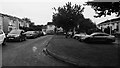
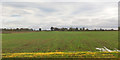
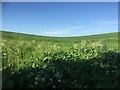
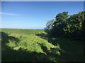
Photos of Preston, Seton and Gosford Ward


Area Information
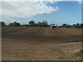
Preston, Seton and Gosford Ward stands as the second most populated district in East Lothian, home to approximately 18,729 residents. This ward stretches along the Forth coast in the western part of the county, covering a total area of 25.1 square kilometres. It elects three Councillors to represent the community within the East Lothian Council structure. The settlements within this ward vary significantly in size and character, ranging from larger towns to smaller villages. Locals often describe their community as an attractive region featuring countryside, coast, and cultural heritage. The area is positioned close to Edinburgh, acting as part of the wider Edinburgh Housing Market Area. This geographical proximity drives significant population growth, with around 70% of this growth expected to stem from net in-migration rather than natural change. Residents express clear aspirations for the area to evolve into a great place to live, work, get around, and visit. The ward functions as a key residential corridor for commuters, yet the settlements maintain distinct identities. Understanding the specific dynamics of Preston, Seton and Gosford Ward is essential for anyone considering this strategic location, as it balances coastal living with direct access to Scotland's capital region.
- Area Type
- District Borough Unitary Ward
- Area Size
- 25.1 km²
- Population
- Not available
- Population Density
- Not available
Demographics
The community within Preston, Seton and Gosford Ward exhibits notable socioeconomic variation. Average household income differs by over £281 per week between the most affluent and least affluent locations inside the ward. Among children, forty-three three individuals, representing 13% of the ward's total child population, live in poverty. This poverty rate mirrors the broader trend across East Lothian generally. However, the distribution is highly uneven, ranging from a high of 35% in certain data zones to as low as 1% in others. In the town centre of Prestonpans, more than one in four private sector households experience fuel poverty. This statistic highlights a specific challenge for residents in that particular locality compared to other parts of the ward. The community has articulated a desire for improvement, seeking to become a place where people can thrive economically and socially. While the area offers an attractive setting with countryside and coast, these financial disparities shape the daily reality for many families. Prospective buyers should be aware that living in Preston, Seton and Gosford Ward involves navigating these significant economic differences.
Household Size
Accommodation Type
Tenure
Ethnic Group
Religion
Household Composition
Age
Household Deprivation
NS-SEC
Explore more demographic insights in this area
Go to Demographics tabPlanning
Planning Constraints
- Flood RiskPremium
- Ramsar Wetland SitesPremium
- Area of Outstanding Natural BeautyPremium
- Protected Nature ReservePremium
- Protected WoodlandPremium
- Crime RiskPremium