Area Overview for Ormiston
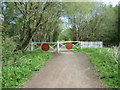
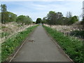
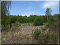
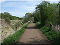
Photos of Ormiston


Area Information
Ormiston is a compact built-up area in Scotland, spanning 59.4 hectares. As a town or city, it offers a mix of residential and community spaces, though its precise population remains unspecified. The area’s proximity to key transport links, including Prestonpans, Wallyford, and Longniddry railway stations, suggests it is well-connected to surrounding regions. Retail options such as Co-op Ormiston, Co-op Tranent, and Spar provide everyday convenience, while the digital connectivity scores—100 for broadband and 82 for mobile—indicate strong internet infrastructure. This positions Ormiston as a practical choice for those prioritising reliable connectivity and accessibility. Though the data does not specify local industries or employment hubs, the presence of multiple railway stations hints at its role in regional commuting networks. For buyers seeking a balance between urban amenities and manageable size, Ormiston’s infrastructure and connectivity make it a viable candidate.
- Area Type
- Built Up Area 250
- Area Size
- 59.4 hectares
- Population
- Not available
- Population Density
- Not available
Daily life in Ormiston is shaped by its accessible amenities. Local shops such as Co-op Ormiston, Co-op Tranent, and Spar offer essential groceries and services, reducing the need for long trips. While specific details on dining or leisure options are absent, the presence of multiple retail outlets suggests a focus on convenience. The rail network, with stations at Prestonpans, Wallyford, and Longniddry, adds to the area’s appeal by linking residents to broader regional opportunities. Though data on parks or recreational spaces is not provided, the compact size of the area may foster a sense of community. For those prioritising practicality, Ormiston’s amenities and transport links provide a functional lifestyle without excessive sprawl.
Amenities
Schools
| Rank | School | Type | Entry gender | Ages |
|---|
Explore more schools in this area
Go to Schools tabDemographics
Household Size
Accommodation Type
Tenure
Ethnic Group
Religion
Household Composition
Age
Household Deprivation
NS-SEC
Explore more demographic insights in this area
Go to Demographics tabPlanning
Planning Constraints
- Crime RiskPremium