Area Overview for EH34 5DY
Photos of EH34 5DY
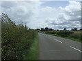
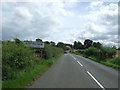
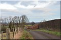
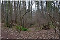
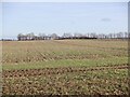
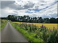
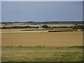
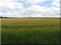
17 photos from this area
Area Information
Key information about the EH34 5DY including its size, population, and administrative classification.
- Area Type
- Postcode
- Area Size
- 41.8 hectares
- Population
- Not available
- Population Density
- Not available
House Prices in EH34 5DY
9
Properties
-
Average Sold Price
-
Lowest Price
-
Highest Price
Showing 9 properties
| Address | Type | Beds | Baths | Last Sale Price | Last Sale Date | |
|---|---|---|---|---|---|---|
| Elm Bank, Main Street, East Saltoun, EH34 5DY | Semi-detached | 4 | 1 | - | - | |
| The Birches, U 134 03 From Blance Road U 134 02 To East Saltoun B 6355, East Saltoun, EH34 5DY | Detached | 4 | - | - | - | |
| Strawberry Wood, U 134 03 From Blance Road U 134 02 To East Saltoun B 6355, East Saltoun, EH34 5DY | Land | - | - | - | - | |
| Fletcher Hall, Main Street, East Saltoun, EH34 5DY | commercial | - | - | - | - | |
| Saltoun Primary School, Main Street, East Saltoun, EH34 5DY | commercial | - | - | - | - | |
| Woodbank, U 134 03 From Blance Road U 134 02 To East Saltoun B 6355, East Saltoun, EH34 5DY | Detached | - | - | - | - | |
| The Old Castle, Main Street, East Saltoun, EH34 5DY | Detached | - | - | - | - | |
| East Saltoun Farmhouse, Main Street, East Saltoun, EH34 5DY | Semi-detached | 6 | - | - | - | |
| Walney Cottage, Main Street, East Saltoun, EH34 5DY | Semi-detached | - | - | - | - |
Energy Efficiency in EH34 5DY
Amenities
Schools
| Rank | School | Type | Entry gender | Ages |
|---|
Explore more schools in this area
Go to Schools tabDemographics
Household Size
N/A
most common
Accommodation Type
N/A
most common
Tenure
N/A
majority
Ethnic Group
N/A
most common
Religion
N/A
most common
Household Composition
N/A
most common
Age
N/A
median
N/A
most common
Household Deprivation
N/A
with no deprivation
NS-SEC
N/A
in Lower managerial occupations
Explore more demographic insights in this area
Go to Demographics tabPlanning
Planning Constraints
- Flood RiskPremium
- Ramsar Wetland SitesPremium
- Area of Outstanding Natural BeautyPremium
- Protected Nature ReservePremium
- Protected WoodlandPremium
- Crime RiskPremium