Area Overview for DD4 7HG
Photos of DD4 7HG


Area Information
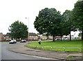
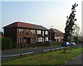
Living in DD4 7HG means being part of a compact, residential cluster nestled within Dundee, Scotland’s first officially designated city. This postcode covers just 1.5 hectares, making it a tightly knit area ideal for those seeking proximity to Dundee’s evolving urban core. Historically shaped by industries like jute and journalism, Dundee has reinvented itself as a hub for education, life sciences, and digital innovation. Residents here benefit from the city’s revitalised Victorian architecture, modern infrastructure, and a cultural identity rooted in its industrial past. The area is served by multiple railway stations, including Dundee Railway Station, which connects to major Scottish cities like Edinburgh and Glasgow in under two hours. With broadband scores of 100 and mobile coverage rated 85, digital connectivity is robust, supporting both remote work and everyday internet use. DD4 7HG’s small size means it is a microcosm of Dundee’s broader character: practical, forward-thinking, and anchored in a rich historical narrative.
- Area Type
- Postcode
- Area Size
- 1.5 hectares
- Population
- Not available
- Population Density
- Not available
House Prices in DD4 7HG
Showing 1 properties
| Address | Type | Beds | Baths | Last Sale Price | Last Sale Date | |
|---|---|---|---|---|---|---|
| Arnold Clark Automobiles Ltd, East Kingsway Works, Kingsway East, Dundee, DD4 7HG | office_workshop | - | - | - | - |
Energy Efficiency in DD4 7HG
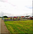
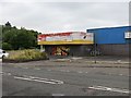
Residents of DD4 7HG have access to a range of amenities within practical reach. Retail options include Lidl Kingsway, Aldi Pitkerro, and Asda Dundee, ensuring everyday shopping needs are met. The area’s railway stations — Dundee, Broughty Ferry, and Balmossie — provide easy access to broader regional travel. While there are no major parks or green spaces listed in the data, Dundee itself offers historic sites like the remnants of town walls and Law Hill’s Iron Age fort. The city’s cultural and educational institutions, including the University of Dundee and Abertay University, contribute to a dynamic local environment. The area’s compact size means daily life is convenient, with shops, transport, and employment opportunities all within close proximity.
Amenities
Schools
| Rank | School | Type | Entry gender | Ages |
|---|
Explore more schools in this area
Go to Schools tabDemographics
Household Size
Accommodation Type
Tenure
Ethnic Group
Religion
Household Composition
Age
Household Deprivation
NS-SEC
Explore more demographic insights in this area
Go to Demographics tabPlanning
Planning Constraints
- Flood RiskPremium
- Ramsar Wetland SitesPremium
- Area of Outstanding Natural BeautyPremium
- Protected Nature ReservePremium
- Protected WoodlandPremium
- Crime RiskPremium