Area Overview for DD2 5NF
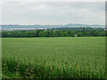
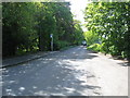
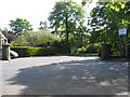
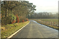
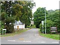
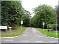
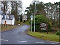
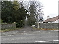
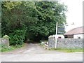
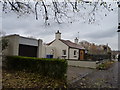
Photos of DD2 5NF


Area Information
DD2 5NF is a small residential postcode in the Lochee area of Dundee City, Scotland. Situated on the north bank of the River Tay, it lies within the historic county of Angus, close to the city’s core. Dundee, as Scotland’s fourth-largest city, offers a blend of historical significance and modern infrastructure. This area benefits from proximity to key transport links, including Invergowrie and Dundee railway stations, and is near two airports, Dundee Airport and Dundee City Airport, making it accessible for travel. The postcode’s compact nature means it is likely to have a tight-knit community feel, with residents living in a mix of terraced and semi-detached properties. While the area does not have significant natural constraints like protected woodlands or wetlands, it is positioned in a region with a long history as a royal burgh and trading port. Daily life here is likely shaped by proximity to retail outlets such as Spar Dykes and Asda Dundee, offering convenience for local shopping. The area’s small size means it is ideal for those seeking a quieter, more localised lifestyle within a city setting.
- Area Type
- Postcode
- Area Size
- Not available
- Population
- Not available
- Population Density
- Not available
House Prices in DD2 5NF
No properties found in this postcode.
Energy Efficiency in DD2 5NF
Living in DD2 5NF offers access to a range of local amenities. Retail options include Spar Dykes, Asda Dundee, and Aldi Myrekirk, providing everyday shopping needs within easy reach. The area’s rail links to Invergowrie and Dundee stations make it convenient for commuting or day trips. While the postcode does not have major parks or leisure facilities listed, its proximity to Dundee’s urban core likely means residents can access larger recreational spaces in the city. The presence of two airports nearby suggests the area may attract those with travel-related jobs or interests. The compact nature of DD2 5NF means amenities are likely clustered closely, supporting a lifestyle that prioritises convenience and local connectivity. However, the lack of detailed information on dining or cultural venues means the area’s character beyond retail and transport remains less defined.
Amenities
Schools
| Rank | School | Type | Entry gender | Ages |
|---|
Explore more schools in this area
Go to Schools tabDemographics
Household Size
Accommodation Type
Tenure
Ethnic Group
Religion
Household Composition
Age
Household Deprivation
NS-SEC
Explore more demographic insights in this area
Go to Demographics tabPlanning
Planning Constraints
- Flood RiskPremium
- Ramsar Wetland SitesPremium
- Area of Outstanding Natural BeautyPremium
- Protected Nature ReservePremium
- Protected WoodlandPremium
- Crime & SafetyPremium