Area Overview for DD2 3XS
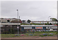
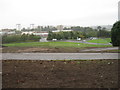
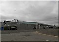
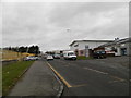
Photos of DD2 3XS


Area Information
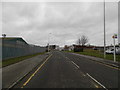
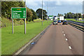
Living in DD2 3XS means being part of a small, tightly knit residential cluster in Dundee, Scotland’s first officially designated city. This postcode area sits at the heart of a place with a rich industrial heritage, now reinvented as a hub for education, life sciences, and digital innovation. Proximity to Dundee’s central railway station and major roads like the A90 and A929 ensures easy access to the city’s evolving urban core, including its historic Tay Rail Bridge and modern universities. The area benefits from excellent broadband connectivity, scoring 98 out of 100, which supports remote work and daily digital needs. Nearby, Dundee City Airport and Dundee Airport provide regional travel options, while local shops like Farmfoods Downfield and Aldi Lochee cater to everyday essentials. DD2 3XS reflects Dundee’s transformation from its “city of jute, jam, and journalism” roots into a modern, forward-thinking community with a strong sense of place and practical infrastructure.
- Area Type
- Postcode
- Area Size
- Not available
- Population
- Not available
- Population Density
- Not available
The property market in DD2 3XS reflects a mix of traditional and contemporary housing, shaped by its role as a small residential cluster within Dundee. While specific home ownership percentages are not provided, the area’s proximity to key amenities and transport links suggests a balance between owner-occupied homes and rental properties. The compact nature of the postcode likely means a concentration of terraced or semi-detached housing, typical of Dundee’s urban fabric. Buyers should consider the area’s integration with the city’s broader housing stock, which includes both historic and newer developments. The absence of planning constraints like protected woodlands or AONB designations makes DD2 3XS a pragmatic choice for those seeking a base in Dundee without complex regulatory hurdles. Its small size means the immediate surroundings offer a range of housing options, from family homes to smaller properties suited to single occupants or couples.
House Prices in DD2 3XS
No properties found in this postcode.
Energy Efficiency in DD2 3XS
Daily life in DD2 3XS is shaped by its proximity to Dundee’s retail, cultural, and recreational offerings. Within practical reach are shops like Farmfoods Downfield, Aldi Lochee, and Spar, providing essentials for residents. The area’s transport links also grant access to Dundee’s historic sites, such as the remnants of town walls and Law Hill’s Iron Age fort. While specific parks or leisure facilities are not detailed in the data, the broader Dundee area offers a range of amenities, from museums to waterfront walks. The presence of two airports and multiple railway stations adds to the area’s convenience, making it easy to explore Scotland’s wider landscape. The blend of practical retail, transport options, and historical context creates a lifestyle that balances modern living with Dundee’s distinctive character.
Amenities
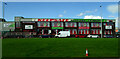
Schools
| Rank | School | Type | Entry gender | Ages |
|---|
Explore more schools in this area
Go to Schools tabDemographics
Household Size
Accommodation Type
Tenure
Ethnic Group
Religion
Household Composition
Age
Household Deprivation
NS-SEC
Explore more demographic insights in this area
Go to Demographics tabPlanning
Planning Constraints
- Flood RiskPremium
- Ramsar Wetland SitesPremium
- Area of Outstanding Natural BeautyPremium
- Protected Nature ReservePremium
- Protected WoodlandPremium
- Crime & SafetyPremium