Area Overview for DD2 2UB
Photos of DD2 2UB


Area Information
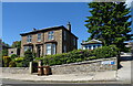
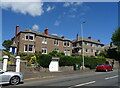
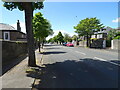
DD2 2UB is a small postcode area in Dundee, Scotland, covering just 14.2 hectares. Situated in the city’s north bank along the River Tay, it reflects Dundee’s transformation from an industrial hub to a modern urban centre. The area is part of a broader residential cluster, with a compact footprint that suggests a tightly knit community. Dundee, designated Scotland’s first city in 1889, has a rich history as a centre for jute, journalism, and innovation. Today, the city thrives on education, life sciences, and digital industries, with institutions like the University of Dundee and Abertay University anchoring its economy. Living in DD2 2UB means being part of a place where historical architecture meets contemporary development. The area’s proximity to transport networks, including three railway stations and two airports, underscores its connectivity. While the postcode is small, it benefits from Dundee’s broader infrastructure, including the A90 and A929 roads, and the Tay Road Bridge linking to Fife. Residents here likely enjoy a balance of urban convenience and access to the city’s evolving cultural and economic landscape.
- Area Type
- Postcode
- Area Size
- 14.2 hectares
- Population
- Not available
- Population Density
- Not available
House Prices in DD2 2UB
Showing 1 properties
| Address | Type | Beds | Baths | Last Sale Price | Last Sale Date | |
|---|---|---|---|---|---|---|
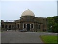
| Mills Observatory, Glamis Road, Dundee, DD2 2UB | Office | - | - | - | - |
Energy Efficiency in DD2 2UB
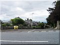
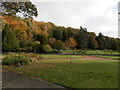
Daily life in DD2 2UB is shaped by its proximity to essential amenities. Retail options include Spar, Farmfoods Lochee, and Morrisons Dundee, providing access to groceries and everyday essentials. The area’s transport links also open up broader opportunities, with nearby railway stations connecting to cultural hubs and employment centres. While the postcode itself is small, its integration with Dundee’s urban fabric means residents can enjoy the city’s amenities, from historic sites like the Tay Rail Bridge to modern institutions like the University of Dundee. The absence of major parks or recreational spaces within the postcode suggests that nearby green spaces or community facilities may be necessary for leisure. However, the area’s compact design and connectivity ensure that residents can easily access both urban and natural environments beyond the immediate postcode.
Amenities
Schools
| Rank | School | Type | Entry gender | Ages |
|---|
Explore more schools in this area
Go to Schools tabDemographics
Household Size
Accommodation Type
Tenure
Ethnic Group
Religion
Household Composition
Age
Household Deprivation
NS-SEC
Explore more demographic insights in this area
Go to Demographics tabPlanning
Planning Constraints
- Flood RiskPremium
- Ramsar Wetland SitesPremium
- Area of Outstanding Natural BeautyPremium
- Protected Nature ReservePremium
- Protected WoodlandPremium
- Crime & SafetyPremium