Area Overview for Broughty Ferry
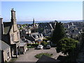
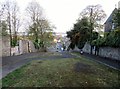
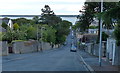
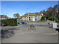
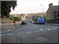
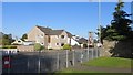
Photos of Broughty Ferry


Area Information
Broughty Ferry sits on the north bank of the Firth of Tay, forming a distinctive built-up area within Dundee City, Scotland. This suburb covers 6.3 km² and combines a planned Victorian seaside character with modern suburban growth. Originally a fishing hamlet known as North Ferry, the area evolved into a resort following George Hunter's town plan in 1801. The location opened officially in 1825 but saw rapid expansion after the Dundee and Arbroath Railway station launched in 1839. Residents here enjoy a prosperous coastal atmosphere defined by Victorian and Edwardian mansions alongside a distinct identity separate from the main city. Key landmarks shape the daily experience, including the restored 15th-century Broughty Castle which houses a museum and conserved armed weaponry from WWII. Queen Street forms the high street, offering shops and cafes along its conservation areas. The Harbour and Castle Green provide open spaces for recreation. Historical transport links include the former rail ferry used until 1887, while contemporary connections rely on the A92 coastal road and Tay Road Bridge. Today, the street name is Queen Street. Shops and restaurants line this thoroughfare, creating a commercial hub for the postcode area of DD1 9RF. The area remains closely linked to Dundee while retaining its own residential charm. You move through streets filled with heritage architecture and easy access to the water. Living in Broughty Ferry offers a blend of coastal peace and urban convenience. The suburb retains its status as a desirable commuter location due to its Victorian planning and proximity to the Firth of Tay. The area developed further in the 20th century as the population grew northwards. Despite this expansion, the core retains its 19th-century curated layout. History in the form of landmarks like Broughty Castle anchors the community narrative. The landscape shifts from the seafront inland, passing through conservation zones before reaching residential cul-de-sacs. This layout ensures that even as the community has expanded, the original vision for a seaside resort remains visible. You walk alongside buildings constructed for leisure and display, not just utility.
- Area Type
- Built Up Area 250
- Area Size
- 6.3 km²
- Population
- Not available
- Population Density
- Not available
Living in Broughty Ferry offers convenient access to a range of retail and leisure amenities within practical reach. Residents can visit Iceland Barnhill, Co-op Dundee, and Aldi 2 Herod Hill Brae for grocery shopping and essentials. These five retail venues cluster in the immediate vicinity, providing everyday comfort without long commutes. Dining and shopping opportunities centre around Queen Street, the area main high street featuring shops and cafes. You find a mix of independent stores and established chains catering to local needs. Transport links support this lifestyle with five nearby rail stations including Broughty Ferry Railway Station, Balmossie Railway Station, and Monifieth Railway Station. This rail network allows you to reach Dundee quickly or access wider Scottish destinations. One airport facility, Dundee City Airport, sits within reasonable distance for occasional travel beyond rail lines. The Harbour and Castle Green offer public spaces for walking and relaxation directly from the home. Broughty Castle provides a cultural landmark and museum experience right on the doorstep. The suburb's five-mile proximity to other services like Monifieth ensures broader shopping access when needed. You do not need to travel far for weekly provisions at the local Aldi or Co-op. The combination of rail, bus, and road options means you plan journeys easily. Digital connectivity scores high, complementing physical amenities. Life here balances coastal leisure with practical utility.
Amenities
Schools
| Rank | School | Type | Entry gender | Ages |
|---|
Explore more schools in this area
Go to Schools tabDemographics
Broughty Ferry forms part of the wider Dundee City local authority. The area functions as a suburban community within the larger Scottish urban landscape. Historical records indicate that the town became part of Dundee in 1913 following earlier growth patterns established in the 19th century. The demographic profile reflects a stable residential population drawn by the suburb's Victorian heritage and coastal setting. You find a community where long-term residents coexist with commuters working in Dundee or beyond. The specific age distribution and household composition stem from this established residential nature rather than transient housing trends. Family homes and established properties dominate the landscape. The 1913 merger with Dundee cemented its role as a residential extension to the main city. Consistent growth after 1839 suggests a tradition of stable, permanent settlement rather than temporary accommodation. The Current population structure includes households seeking access to the Harbour and Castle Green while maintaining employment links to Dundee. The area attracts those who value the conservation areas and seaside atmosphere for their families. Home ownership levels typically correlate with the high concentration of Victorian mansions and planned developments from 1801. Diversity in the community arises from the varied architectural styles and historical layers accumulated over two centuries. You encounter a mix of original Victorian residents and newer arrivals drawn to the established character. Accommodation types range from homes near the railway station to properties further inland. The planned layout introduced by George Hunter influences current neighbourhood cuts and street names. Security measures and community involvement often revolve around proximity to schools near the area and local council initiatives. The Housing stock reflects the 19th-century focus on aesthetic presentation and leisure. This history creates a demographic environment where stability prevails. The area does not cater to floating populations but to settled households. When considering homes in Broughty Ferry, you are entering a market defined by legacy and continuity. The community feel relies on this deep historical root rather than modern migration patterns.
Household Size
Accommodation Type
Tenure
Ethnic Group
Religion
Household Composition
Age
Household Deprivation
NS-SEC
Explore more demographic insights in this area
Go to Demographics tabPlanning
Planning Constraints
- Crime & SafetyPremium