Area Overview for Langholm
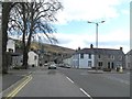
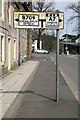
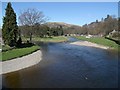
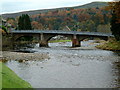
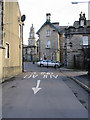
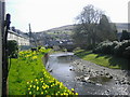
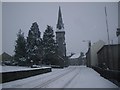
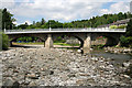
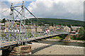
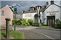
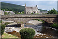
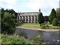
Photos of Langholm
Area Information
Langholm occupies a distinct position within the Scottish landscape as a built-up town covering 75.5 hectares. This size defines the physical footprint of the community, shaping the daily rhythm for anyone considering living in Langholm. The area functions as a traditional town rather than a sprawling city, meaning your environment remains compact and manageable. Residents experience a setting where distance between home, work, and shops often involves short walks or quick drives. The character of Langholm is defined by its established nature and its location in the heart of Scotland. You will find a residential environment that prioritises settled living over the pace of larger urban centres. The scale of the town suggests a slower, more deliberate way of life that contrasts with the density of major metropolitan areas nearby. When you look at the land use, you see a town that has developed around its own specific identity. This built-up form ensures that amenities are not scattered across the country but are concentrated in one place. Living in Langholm means embracing a community where the boundaries are clear and the atmosphere is rooted in local traditions. The town does not aspire to be a global hub; instead, it offers a grounded existence for families and individuals seeking stability. Your homebase here will be defined by this specific, tangible presence on the map.
- Area Type
- Built Up Area 250
- Area Size
- 75.5 hectares
- Population
- Not available
- Population Density
- Not available
Daily life in Langholm revolves around a limited but specific range of amenities within practical reach. The most notable retail option is the Co-op Langholm, which serves as the primary grocery and convenience hub for the town. This single local store forms the centre of your shopping routine. You will find few other large retail outlets or supermarkets immediately surrounding your home. The lack of variety means your weekly shopping will likely consist mainly of what the Co-op provides. Given the town size, dining choices and leisure facilities are similarly constrained. There are no major shopping centres, cinemas, or large leisure parks listed in the immediate vicinity. Your lifestyle in Langholm is characterised by a focus on essential services rather than a wide array of entertainment options. Residents often look beyond the town centre for broader retail or social activities. The convenience of living here comes from the proximity to the Co-op, not from a bustling commercial district. You must plan your outside visits for shopping or leisure. The character of Langholm is quiet and community-focused, dependent on one main commercial venue for daily supply needs.
Amenities
Schools
| Rank | School | Type | Entry gender | Ages |
|---|
Explore more schools in this area
Go to Schools tabDemographics
The population structure of Langholm reflects a settled community typical of small Scottish towns. While detailed breakdowns of age groups or specific deprivation indices are not included in the available records, the overall picture suggests a stable resident base. Information regarding specific household types, such as the number of single-person homes versus families, is absent from the current dataset. Similarly, exact figures on home ownership levels versus renting remain unspecified for this location. You cannot determine the precise diversity of the population or the exact split between owner-occupiers and tenants based on the provided information. Accommodation type data is also not available, so you cannot say whether the housing stock is primarily modern flats or older detached homes. Without these specific metrics, it is impossible to define the social composition of Langholm with statistical precision. The lack of published figures means you relying on general knowledge of the region rather than hard data. Any claims about the wealth of residents or the average age of the population would be speculation without supporting numbers. Consequently, the demographic profile of Langholm remains undefined in the current records. Buyers should approach the social makeup of the town with an understanding that specific numerical trends are not disclosed. The community exists and functions, but the detailed stats that usually describe such populations are not present.
Household Size
Accommodation Type
Tenure
Ethnic Group
Religion
Household Composition
Age
Household Deprivation
NS-SEC
Explore more demographic insights in this area
Go to Demographics tabPlanning
Planning Constraints
- Crime RiskPremium