Area Overview for Eastriggs
Photos of Eastriggs


Area Information
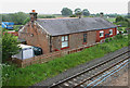
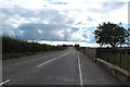
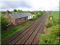
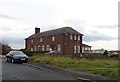
Eastriggs is a small built-up area in Scotland, covering 69.6 hectares. It is situated in a region with a mix of rural and urban characteristics, offering a blend of practical living with proximity to essential services. The area is served by two railway stations—Annan and Gretna Green—providing straightforward access to nearby towns and cities. For daily needs, residents have access to five retail outlets, including Spar, Tesco Annan, and Farmfoods Annan, ensuring convenience for shopping and essentials. While Eastriggs is compact, its strategic location makes it a viable option for those seeking a balance between local amenities and broader connectivity. The area’s size suggests a close-knit community, though its population details remain unspecified. Living here would involve navigating a modest range of services, with the nearby rail links and retail options forming the backbone of daily life. The presence of these amenities, combined with the area’s built-up nature, positions Eastriggs as a practical choice for those prioritising accessibility over expansive urban features.
- Area Type
- Built Up Area 250
- Area Size
- 69.6 hectares
- Population
- Not available
- Population Density
- Not available
Eastriggs offers a straightforward lifestyle with access to essential amenities within practical reach. The retail options include Spar, Tesco Annan, and Farmfoods Annan, providing a range of shopping and grocery needs. These stores cater to daily requirements, though the selection may be limited compared to larger towns. The two nearby railway stations—Annan and Gretna Green—add to the area’s convenience, enabling travel to surrounding regions. While the area does not feature parks or leisure facilities in its immediate vicinity, the presence of rail links and retail options suggests a focus on practicality over extensive recreational amenities. The character of Eastriggs is defined by its compactness and reliance on nearby services, making it suitable for those prioritising accessibility over expansive leisure opportunities. The lifestyle here is likely to be quiet, with a community-oriented feel, though the absence of detailed data on parks or cultural venues means the full range of activities remains unspecified.
Amenities
Schools
| Rank | School | Type | Entry gender | Ages |
|---|
Explore more schools in this area
Go to Schools tabDemographics
Household Size
Accommodation Type
Tenure
Ethnic Group
Religion
Household Composition
Age
Household Deprivation
NS-SEC
Explore more demographic insights in this area
Go to Demographics tabPlanning
Planning Constraints
- Crime RiskPremium