Area Overview for DG1 4UA
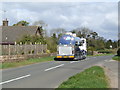
Photos of DG1 4UA

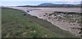
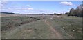
![Merse [salt marsh] on the west bank of the River Nith in DG1 4UA](https://images.propbar.co.uk/images/geograph/63/88/6388202_120.jpg)


10 photos from this area
Area Information
Key information about the DG1 4UA including its size, population, and administrative classification.
- Area Type
- Postcode
- Area Size
- 54.3 hectares
- Population
- Not available
- Population Density
- Not available
House Prices in DG1 4UA
23
Properties
-
Average Sold Price
-
Lowest Price
-
Highest Price
Showing 23 properties
| Address | Type | Beds | Baths | Last Sale Price | Last Sale Date | |
|---|---|---|---|---|---|---|
| Kelton Cottage, Glencaple Road, Dumfries, DG1 4UA | Bungalow | 2 | 1 | - | - | |
| Anahata, Glencaple Road, Dumfries, DG1 4UA | Cottage | 2 | 1 | - | - | |
| The Swallows, Access To Riverside Cottage Private Road, Kelton, Dumfries, DG1 4UA | Bungalow | 5 | 3 | - | - | |
| Corner House, Access To Riverside Cottage Private Road, Kelton, Dumfries, DG1 4UA | Detached | 4 | - | - | - | |
| Kelton, Glencaple Road, Dumfries, DG1 4UA | Detached | - | - | - | - | |
| 1 Boreland Cottage, Access To Boreland Cottage Private Road, Dumfries, DG1 4UA | Bungalow | - | - | - | - | |
| Laurel House, Glencaple Road, Dumfries, DG1 4UA | Semi-detached | - | - | - | - | |
| Craigard, Glencaple Road, Dumfries, DG1 4UA | Bungalow | - | - | - | - | |
| Park Cottage, Glencaple Road, Dumfries, DG1 4UA | Bungalow | - | - | - | - | |
| Kelton Villa, Access To Riverside Cottage Private Road, Kelton, Dumfries, DG1 4UA | Semi-detached | - | - | - | - |
Page 1 of 3
Energy Efficiency in DG1 4UA
Amenities
Schools
| Rank | School | Type | Entry gender | Ages |
|---|
Explore more schools in this area
Go to Schools tabDemographics
Household Size
N/A
most common
Accommodation Type
N/A
most common
Tenure
N/A
majority
Ethnic Group
N/A
most common
Religion
N/A
most common
Household Composition
N/A
most common
Age
N/A
median
N/A
most common
Household Deprivation
N/A
with no deprivation
NS-SEC
N/A
in Lower managerial occupations
Explore more demographic insights in this area
Go to Demographics tabPlanning
Planning Constraints
- Flood RiskPremium
- Ramsar Wetland SitesPremium
- Area of Outstanding Natural BeautyPremium
- Protected Nature ReservePremium
- Protected WoodlandPremium
- Crime RiskPremium