Area Overview for Caithness
Photos of Caithness

Area Information
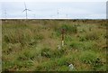
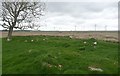
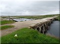
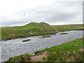
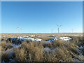
Caithness stands as a distinct ceremonial county in the far north of mainland Scotland, covering an expansive 1,818.0 km². It forms a roughly triangular area on the east side, facing the Atlantic Ocean, the Pentland Firth, and the North Sea. This historic region includes Dunnet Head, the northernmost point of Great Britain east of Thurso. The location sits around coordinates 58.4297°N, -3.4653°W, bordered to the south by Sutherland. Today, it operates as part of the Highland Council area within the "Caithness, Sutherland and Easter Ross" operational framework. Living in Caithness means engaging with a landscape defined by its geography and deep history. The area became a fully separate shire by 1641 with Wick established as the head burgh. While the Heritable Jurisdictions Act of 1746 ended hereditary sheriff roles, the region retains its identity as a lieutenancy and registration area. You will find a place where the past remains visible alongside the natural coastline. The unique boundary facing the Atlantic creates a specific daily life for residents accustomed to the elements. Understanding this geographical spread helps you appreciate the scope of the region you are considering for your next home.
- Area Type
- Ceremonial Counties Region
- Area Size
- 1818.0 km²
- Population
- Not available
- Population Density
- Not available
Demographics
Detailed community statistics for Caithness are currently unavailable in the provided information. Consequently, specific figures regarding age profiles, household types, home ownership levels, or accommodation diversity cannot be stated. Deprivation data is also missing from the available dataset. Without these concrete numbers, any attempt to describe the demographic makeup would rely on speculation rather than fact. You cannot identify whether a specific age group dominates the population or determine the ratio of homeowners to renters without access to current census or survey data. Similarly, information about the diversity of the population or the specific types of homes that predominate is absent. This lack of granular data means you must rely on general knowledge of the region rather than hard statistics from this source. While the historical context indicates the area has long been established, the modern breakdown of its residents remains unquantified in this report.
Household Size
Accommodation Type
Tenure
Ethnic Group
Religion
Household Composition
Age
Household Deprivation
NS-SEC
Explore more demographic insights in this area
Go to Demographics tabPlanning
Planning Constraints
- Crime RiskPremium