Area Overview for Stewarton
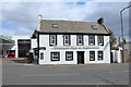
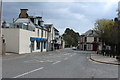
Photos of Stewarton


Area Information
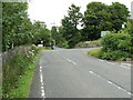
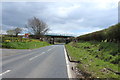
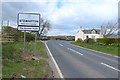
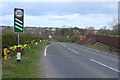
Living in Stewarton offers a clear and practical picture for those seeking a built-up area in Scotland. This town covers a compact 2.4 km² footprint, shaping a tight and accessible environment where daily routines remain manageable. You find a settled community defined by its location near major transport corridors rather than rural isolation. The area functions as a functional hub for the surrounding Lowlands, providing immediate access to rail links without the congestion of larger cities. Residents here enjoy the benefits of a self-contained neighbourhood where essential services are within walking or a short drive away. Daily life revolves around convenience, with the town centre serving as the primary node for shopping and local interaction. The physical scale of Stewarton means that distances between homes, shops, and stations are minimal, reducing travel time significantly for commuters. This compact nature allows you to integrate work, leisure, and family activities into a single, efficient loop. Whether you are looking for a quiet residential street or a spot closer to the main thoroughfare, the layout ensures that your commute to Dunlop or Kilmaurs remains brief. The area does not attempt to disguise its modest size; instead, it embraces the efficiency that comes with living in a small, well-connected Scottish town.
- Area Type
- Built Up Area 250
- Area Size
- 2.4 km²
- Population
- Not available
- Population Density
- Not available
Your daily lifestyle in Stewarton centres around practical amenities located within practical reach. You do not need to travel far for essential shopping or community services. Three major supermarkets operate nearby, including Aldi, Sainsburys Stewarton, and Co-op Stewarton. These retailers provide comprehensive weekly provisions, from fresh produce to household goods, ensuring your shopping trips are efficient. For rail commuters, the presence of four stations within reach offers flexibility. You can catch trains from Stewarton Railway Station or utilise the nearby Dunlop and Kilmaurs stations depending on your destination. Beyond essentials, the town supports a functional routine without requiring car dependence for basic needs. While specific dining or leisure venues are not listed in the current data, the proximity of national retailers suggests a town centre capable of supporting diverse needs. You can live in Stewarton knowing that grocery runs and school runs are manageable within the 2.4 km² layout. The town functions as a self-catering hub where you can meet most daily requirements locally. This accessibility reduces stress from planning errands and allows you to focus on work or family time. The combination of local superstores and rail access creates a balanced lifestyle suitable for families and workers alike.
Amenities
Schools
| Rank | School | Type | Entry gender | Ages |
|---|
Explore more schools in this area
Go to Schools tabDemographics
The demographic profile of Stewarton presents a straightforward snapshot of its resident population. Data confirms that home ownership stands at 96%, indicating that the vast majority of people in this community own their homes outright. This high ownership rate suggests a stable, settled population with deep roots in the locality rather than a fluctuating rental market. You are likely to encounter neighbours who understand the value of long-term investment in their property. The community reflects traditional Scottish settlement patterns where ownership drives local engagement and civic responsibility. Accommodation types remain largely conventional, aligning with the broader trends of owner-occupied housing in rural Scotland. While specific breakdowns of residential units are not detailed in current records, the dominance of ownership implies a housing stock built for permanence. Families and retirees form the core of the demographic landscape, given the secure tenure of most residents. This stability often translates into predictable neighbourhood dynamics and established community networks. When you consider homes in Stewarton, you are entering an environment where property values are tied to enduring local character. The 96% ownership figure is a strong indicator that this is not a transient community but a place where people intend to stay.
Household Size
Accommodation Type
Tenure
Ethnic Group
Religion
Household Composition
Age
Household Deprivation
NS-SEC
Explore more demographic insights in this area
Go to Demographics tabPlanning
Planning Constraints
- Crime RiskPremium