Area Overview for Stevenston
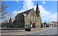
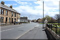
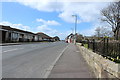
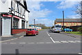
Photos of Stevenston


Area Information
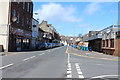
Living in Stevenston offers a distinct slice of coastal life within Ayrshire. This built-up area covers 3.1 km², forming a compact town where daily needs are often within walking distance. You will find a community defined by its proximity to the sea and its strong integration with neighbouring towns. The locality sits close to the stunning coastline, providing easy access to water-based recreation while maintaining a grounded, village feel. Residents enjoy a’ way o’ life that balances practical convenience with a connection to the wider region. The town acts as a local hub for those seeking a slower pace compared to larger urban centres yet still wants access to modern retail and transport links. Homes here provide a stable base for families and individuals who value a straightforward approach to neighbourhood living. The area's small size means you will know your immediate surroundings and neighbours. Daily life revolves around this centralised layout, making it ideal for those who prefer not to rely on cars for short trips. You get a settled environment where the rhythm of life moves at a steady, reassuring pace.
- Area Type
- Built Up Area 250
- Area Size
- 3.1 km²
- Population
- Not available
- Population Density
- Not available
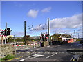
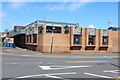
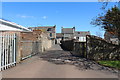
Your daily life in Stevenston benefits from a convenient array of amenities within practical reach. Retail options include Lidl Stevenston, Morrisons Stevenston, and Tesco Saltcoats, ensuring you have your weekly groceries and essentials covered. You have five railway stations nearby, including Stevenston Railway Station, Saltcoats Railway Station, and Kilwinning Railway Station, making commuting a straightforward task. For those interested in exploring further afield, the Ardrossan Ferry Terminal is one ferry port available for travel to other regions. This transport network means you do not need a car for every journey. Local shops and supermarkets are integrated into your weekly routine, reducing the need for long travel times. The combination of rail access and local retail creates a self-contained environment. You can run errands, catch a train, and visit leisure spots without leaving the immediate vicinity. This level of accessibility defines the character of living in Stevenston, providing independence and convenience.
Amenities
Schools
| Rank | School | Type | Entry gender | Ages |
|---|
Explore more schools in this area
Go to Schools tabDemographics
The community in Stevenston reflects a typical small-town profile with specific characteristics regarding household composition. Data indicates that the area has a general mix of residents living in various accommodation types. While exact population figures are not provided, the nature of this built-up area suggests a density consistent with a town rather than a rural village. You will encounter a range of household sizes, from single occupants to families sharing larger properties. The demographic makeup includes people from diverse backgrounds contributing to the local culture. There is no data indicating extreme age segregation, suggesting a community where different generations coexist. Deprivation levels are not detailed for this specific area in the current dataset, but the area remains a standard residential zone. The social fabric is characterised by established routines and local interaction. Parents will find suitable schooling options nearby, and workers will appreciate the mix of commuting opportunities and local employment. The resident population enjoys a lifestyle that is neither overly isolated nor overcrowded. This balance supports a steady social life with reliable access to essential services.
Household Size
Accommodation Type
Tenure
Ethnic Group
Religion
Household Composition
Age
Household Deprivation
NS-SEC
Explore more demographic insights in this area
Go to Demographics tabPlanning
Planning Constraints
- Crime RiskPremium