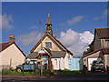
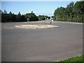
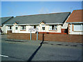
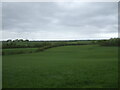
Area Overview for Springside
Photos of Springside


Area Information
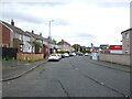
Springside is a compact built-up area in Scotland, spanning 32.4 hectares. Its size suggests a focused, perhaps tightly knit community, though the exact population is not specified. Located near key transport links, it benefits from proximity to multiple railway stations, including Kilmaurs, Irvine, and Kilmarnock, which connect residents to broader regional networks. The area also lies within reach of Troon Ferry Terminal, offering access to coastal routes. Digital connectivity is strong, with a broadband score of 97 and a mobile coverage score of 82, both indicating excellent quality. This positions Springside well for those requiring reliable internet for work or daily life. The presence of five retail outlets, including Co-op Dreghorn and Spar, suggests a mix of local shopping options. While the area’s character remains understated, its infrastructure and connectivity make it a practical choice for commuters and those prioritising convenience.
- Area Type
- Built Up Area 250
- Area Size
- 32.4 hectares
- Population
- Not available
- Population Density
- Not available
Living in Springside offers access to a range of practical amenities. Five retail outlets, including Co-op Dreghorn and Spar, provide everyday shopping convenience. The area’s rail links to Kilmaurs, Irvine, and Kilmarnock stations support easy travel to nearby towns, while the Troon Ferry Terminal offers coastal connectivity. Though the data does not specify parks or leisure facilities, the presence of multiple transport options and retail points suggests a functional, community-oriented environment. Residents can rely on nearby services for daily needs, though the area’s character appears to prioritise practicality over expansive recreational spaces.
Amenities
Schools
| Rank | School | Type | Entry gender | Ages |
|---|
Explore more schools in this area
Go to Schools tabDemographics
Household Size
Accommodation Type
Tenure
Ethnic Group
Religion
Household Composition
Age
Household Deprivation
NS-SEC
Explore more demographic insights in this area
Go to Demographics tabPlanning
Planning Constraints
- Crime RiskPremium