Area Overview for PA17 5HE
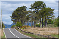
Photos of PA17 5HE


Area Information
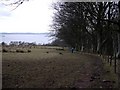
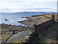
PA17 5HE represents a specific residential cluster covering 11.7 hectares within the broader North Ayrshire lieutenancy area. This postcode falls under the jurisdiction of the council area that includes the Isle of Arran, placing it firmly on the west coast of Scotland along the Firth of Clyde. Residents here benefit from being part of a region often branded as a tourist destination, which encompasses both coastal settlements and island communities. The location sits at coordinates 55.62216, -4.473588, grounding it in a landscape with deep historical roots stretching from the Neolithic age through Roman invasion and Viking settlements. While the immediate area is a small residential pocket, it connects to the larger cultural identity of Ayrshire and Arran. The historic county town of Ayr, situated nearby, was made a Royal Burgh in 1205 and served as a central market and harbour during the Middle Ages. Living in this postcode means enjoying proximity to a region famous for its rich heritage, including the birthplace of Scottish bard Robert Burns in Alloway. The area offers a quiet existence but remains linked to the wider economic and cultural fabric of North Ayrshire, which has undergone significant local government reorganisation since the 1970s and 1990s.
- Area Type
- Postcode
- Area Size
- 11.7 hectares
- Population
- Not available
- Population Density
- Not available
The specific property market characteristics for PA17 5HE, including home ownership percentages and the variety of accommodation types, are not currently available in the provided information. It is not possible to state whether this 11.7 hectare residential cluster consists primarily of terraced homes, semi-detached properties, or detached houses. There is no data illustrating the split between owner-occupiers and private landlords within this postcode. Buyers looking for homes in PA17 5HE cannot rely on standard statistics regarding property values, average prices per square metre, or year-of-build distributions. The absence of these key figures prevents a complete analysis of the housing stock composition. While the area is described as a small residential cluster, the lack of market data means there is no evidence to suggest if the property market is stable, competitive, or dominated by any particular investor group. Prospective purchasers must be aware that granular data on the local housing supply and tenure splits is not present for this location.
House Prices in PA17 5HE
Showing 2 properties
| Address | Type | Beds | Baths | Last Sale Price | Last Sale Date | |
|---|---|---|---|---|---|---|
| Manor Park Hotel, Access From C 118 To Manor Park Hotel, Skelmorlie, PA17 5HE | hotel | - | - | - | - | |
| Manor Park Hotel Flat, Access From C 118 To Manor Park Hotel, Skelmorlie, PA17 5HE | Flat | - | - | - | - |
Energy Efficiency in PA17 5HE
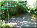
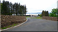
Residents of PA17 5HE enjoy access to a practical range of amenities within walking or short driving distance, ensuring daily needs are easily met. For groceries, three specific retailers serve the community: a Morrisons Daily, a Farmfoods Largs, and a Co-op Promenade. These outlets provide essential shopping without the need for long commerrals. Transport links are robust, with four railway stations nearby including Wemyss Bay Railway Station, Largs Railway Station, and Inverkip Railway Station, offering rail connections to wider Scotland. Travelers can also access three ferry terminals, including Cumbrae Ferry Terminal, Millport Pier Ferry Terminal, and Fairlie Ferry Terminal, making island hopping and coastal travel convenient. A small retail network of five outlets supports local commerce. The lifestyle here is defined by these accessible services rather than major cultural hubs or extensive leisure parks within the immediate 11.7 hectare zone. Daily life revolves around stopping at Co-op for essentials or catching a train from the nearest station to access broader amenities in larger towns like Largs or Ayr.
Amenities
Schools
| Rank | School | Type | Entry gender | Ages |
|---|
Explore more schools in this area
Go to Schools tabDemographics
Data regarding the specific age profile, household types, or diversity of the community within PA17 5HE is not available in the current dataset. Consequently, it is impossible to describe the exact demographic makeup of those living in this specific 11.7 hectare cluster. Information on home ownership levels, the ratio of renters to owners, or the distribution of single-person versus multi-generational households has not been provided for this postcode. Without these specific figures, any attempt to characterise the population density or family structures would be speculative and incorrect. The lack of published statistics means prospective buyers cannot rely on general trends from neighbouring postcodes to accurately gauge the environment in PA17 5HE. Similarly, there is no metrics data to indicate the level of deprivation or socio-economic status of the residents in this small residential zone. Any claim about the types of families or age groups residing here would be an invention rather than a fact.
Household Size
Accommodation Type
Tenure
Ethnic Group
Religion
Household Composition
Age
Household Deprivation
NS-SEC
Explore more demographic insights in this area
Go to Demographics tabPlanning
Planning Constraints
- Flood RiskPremium
- Ramsar Wetland SitesPremium
- Area of Outstanding Natural BeautyPremium
- Protected Nature ReservePremium
- Protected WoodlandPremium
- Crime & SafetyPremium