Area Overview for Mauchline
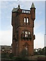
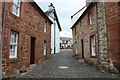
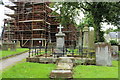
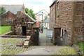
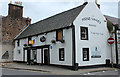
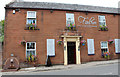
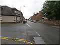
Photos of Mauchline


Area Information
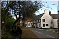
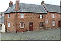
Mauchline is a compact built-up area covering just 1.2 km² in Scotland. Residents enjoy a sense of intimacy within this small footprint while retaining access to broader regional networks. The town functions as a distinct community hub without the overwhelming scale of larger urban centres. You will find a close-knit environment where daily life moves at a manageable pace. This tight concentration means services and amenities cluster within easy walking or cycling distance. The area has maintained its character as a significant local centre within Ayrshire. Living in Mauchline offers a balance between rural quietness and town convenience. The limited size supports strong community cohesion and local identity. You are part of a defined neighbourhood where everyone knows everyone. This manageable scale makes navigation straightforward for new residents and families alike. The town serves as a practical base for those seeking a smaller town experience in a larger county. Your daily routine benefits from this compact arrangement where destinations remain close at hand.
- Area Type
- Built Up Area 250
- Area Size
- 1.2 km²
- Population
- Not available
- Population Density
- Not available
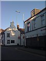
Retail options in Mauchline are immediate and practical for daily shopping needs. Co-op Mauchline, Spar, and Morrisons Daily all operate within the town boundaries. These venues provide comprehensive grocery and essential goods without requiring a long drive. You can complete your weekly filling station trip and household top-ups entirely within the area. Local access reduces time spent commuting to larger towns for routine purchases. The presence of three major retailers creates a convenient commercial core for residents. Transport links extend further via Auchinleck Railway Station, located nearby. This rail option provides a direct connection to wider networks beyond the immediate town. Residents can easily access Ayrshire and Glasgow routes via this station. The combination of local shops and rail access creates a flexible lifestyle balance. You gain self-sufficiency through local retail while retaining flexibility for travel when required.
Amenities
Schools
| Rank | School | Type | Entry gender | Ages |
|---|
Explore more schools in this area
Go to Schools tabDemographics
Current data does not provide specific demographic breakdowns for Mauchline. You cannot assess age profiles, household compositions, or diversity metrics from the available information. Without these figures, you cannot determine the proportion of families, singles, or retirees living in the area. The lack of granular demographic data means you must rely on the broader reputation of the town rather than statistical evidence. You do not possess information on home ownership levels or accommodation types from this dataset. It remains impossible to confirm whether most residents own their homes or rent their properties. The absence of deprivation scores prevents any assessment of socio-economic status within the community. Prospective buyers cannot use statistics to gauge the typical resident profile. This gap requires you to visit the area or consult other sources for human insights. You must accept that the written record for Mauchline lacks these specific community details.
Household Size
Accommodation Type
Tenure
Ethnic Group
Religion
Household Composition
Age
Household Deprivation
NS-SEC
Explore more demographic insights in this area
Go to Demographics tabPlanning
Planning Constraints
- Crime RiskPremium