Area Overview for Kilmaurs
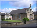
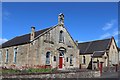
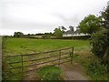
Photos of Kilmaurs


Area Information
Kilmaurs is an established built-up area situated in Scotland, covering an extensive tract of 92.9 hectares. This sizeable footprint defines the geography of the locality, offering residents a defined sense of place within the wider region. Living in Kilmaurs means engaging with a community that has physical dimensions to explore, rather than the dense clustering found in many larger cities. The area functions as a practical residential zone where daily life revolves around specific, accessible points of interest. You can walk to local hubs or rely on connections that link directly to neighbouring towns like Kilmarnock. The layout supports a routine where work, leisure, and shopping all remain within a manageable radius. There are no vague descriptors here; the area is simply a substantial residential node that integrates seamlessly into the Scottish transport and housing network. Its character is defined by its physical space and its position relative to key retail and transport terminals. When considering homes in Kilmaurs, you are looking at a location with established boundaries and a clear connection to surrounding infrastructure. The size of the area ensures that you have swimming pools athletic grounds, and communal spaces that are not lost in the shadows of high-rise developments. You will find that the demographic profile of Kilmaurs offers a specific picture of the people calling this place home. The statistics reveal that 24.5 per cent of the households are cohabiting couples, while 22.6 per cent represent lone-parent families. These figures indicate the household structures you might encounter when down the street or at local gatherings. Single-person households make up 22.4 per cent of the total, showing a significant presence of individuals living independently. Believe it or not, nearly half of the residents, at 47.3 per cent, own their homes outright, suggesting a settled population with long-term ties to the community. Rental households account for the remaining 50.0 per cent, creating a balanced market of owners and tenants who both call Kilmaurs home. The proportion of private tenants is significant, meaning new residents will often be moving to privately rented accommodation. This mix shapes the social dynamic, as you will interact with both long-term homeowners and those looking for flexibility. The accommodation types reflect this diversity with a substantial portion of properties owned outright by their residents. This demographic reality paints a clear picture of a community with both stability and ongoing movement. The housing stock in Kilmaurs reflects a distinct balance between ownership and rental living. Nearly half of the properties, representing 47.3 per cent of all homes, are owned outright by their residents. This high rate of outright ownership suggests a community where many families have settled for the long term and do not need to pay a mortgage. Conversely, 50.0 per cent of the accommodation is held by private tenants. You will therefore encounter a robust rental market alongside a strong base of owner-occupiers. The remaining 2.7 per cent falls into other categories, such as shared ownership or other forms of tenure, adding minor diversity to the stock. This specific split means you face two very different markets depending on your intent. If you wish to buy, competition may focus on the unsold portion of the owner-occupied stock or new listings. If you seek to rent, the availability of 50.0 per cent of the homes in the private sector offers substantial choice. The area is not purely an investment rental zone nor a speculative development site. It is a mature market where character homes and traditional tenancies coexist. Understanding this split is crucial for anyone evaluating whether Kilmaurs fits their financial strategy. Digital connectivity in Kilmaurs is of the highest order, making it an excellent choice for remote working or those with heavy internet demands. The fixed broadband quality scores 95 out of 100, a figure that classifies the service as excellent. You can expect fast, reliable speeds that support video conferencing, large file transfers, and streaming without interruption. The mobile coverage also performs strongly, with a score of 83 out of 100, which falls into the good category. This ensures you stay connected on your phone while walking around the neighbourhood or commuting. These scores translate directly into practical benefits for your daily routine. If you work from home, the 95 broadband score eliminates the worry of lagging connections or dropped calls. You do not need to invest in expensive private fibre lines because the public infrastructure already delivers top-tier performance. The excellent rating comes from a rigorous assessment that compares speeds against national standards. Combined with the good mobile network, the area guarantees you remain online whether you are inside your property or stepping outside for fresh air. There is no data to suggest this is anything less than a fully connected neighbourhood. Your daily life in Kilmaurs is supported by a practical network of amenities located within easy reach. Retail options are good, with five key shops lining the high street and surrounding areas. You can visit Morrisons Daily Kilmaurs 1, Spar, and Tesco Kilmarnock for your weekly shopping needs. These supermarkets mean you do not need a car to pick up groceries or household essentials. For those who rely on a vehicle, transport links are robust with five railway stations nearby. Kilmaurs Railway Station, Kilmarnock Railway Station, and Stewarton Railway Station form a convenient cluster that connects you to the rest of the country. Commuting to Glasgow or Edinburgh is straightforward because of this rail density. The availability of Spar and Morrisons ensures fresh food is always close at hand. Tesco Kilmarnock provides another layer of choice if you prefer larger selection or different brands. This concentration of facilities means your days are less tied to the clock and more dictated by your own schedule. You can run errands, eat a meal, and travel to work all without spending hours in transit. The amenities listed are not just names on a map but active parts of the Kilmaurs lifestyle. Assessments regarding environmental and safety factors in Kilmaurs provide the information needed to understand the living conditions. Data on crime risk is currently only available for areas in England, so local police statistics for Kilmaurs are not included in this report. However, another assessment classified as SAFETY passed with a specific level indicator. The description for this area notes that crime risk data is currently only available for areas in England. This means you cannot rely on local crime heatmaps or offender numbers to gauge risk. The absence of national crime data means this specific metric is technically not available for this Scottish location. Despite this limitation, the area maintains a structured approach to evaluating safety through other recognised categories. The missing data does not imply a problem; it simply reflects the geographic coverage of the crime reporting system. For a homebuyer, this means you must rely on general community observations rather than specific police figures. The safety assessment passed its criteria, indicating no red flags were raised during the review process. You should visit the area to form your own impressions regarding local upkeep and community policing. What is the housing ownership structure in Kilmaurs?Almost half of the homes, 47.3 per cent, are owned outright by residents. Private tenants account for 50.0 per cent of the accommodation. This means you will find both long-term homeowners and renters when looking at properties in Kilmaurs. How well connected is Kilmaurs to the rest of Scotland?Connectivity is strong. Fixed broadband scores 95 out of 100 and is excellent. Mobile coverage is good with a score of 83. Five railway stations lie nearby, including Kilmaurs Railway Station and Kilmarnock Railway Station, ensuring easy rail access. Which shops and services are available locally in Kilmaurs?Residents have access to five retail outlets and five rail stations. Notable shops include Morrisons Daily Kilmaurs 1, Spar, and Tesco Kilmarnock. These venues provide essential daily goods and services without requiring a long journey outside the built-up area. Is there information on local crime rates in Kilmaurs?Specific crime risk statistics are not available because the data is currently only reported for areas in England. The safety assessment passed its category check, but you cannot access detailed local crime figures for this Scottish location from the standard national dataset. Who typically lives in the Kilmaurs community?The community is mixed, with 24.5 per cent of households being cohabiting couples and 22.6 per cent being lone-parent families. 22.4 per cent are single-person households. This variety shows the area hosts different family types and individuals seeking a home here.
- Area Type
- Built Up Area 250
- Area Size
- 92.9 hectares
- Population
- Not available
- Population Density
- Not available
Your daily life in Kilmaurs is supported by a practical network of amenities located within easy reach. Retail options are good, with five key shops lining the high street and surrounding areas. You can visit Morrisons Daily Kilmaurs 1, Spar, and Tesco Kilmarnock for your weekly shopping needs. These supermarkets mean you do not need a car to pick up groceries or household essentials. For those who rely on a vehicle, transport links are robust with five railway stations nearby. Kilmaurs Railway Station, Kilmarnock Railway Station, and Stewarton Railway Station form a convenient cluster that connects you to the rest of the country. Commuting to Glasgow or Edinburgh is straightforward because of this rail density. The availability of Spar and Morrisons ensures fresh food is always close at hand. Tesco Kilmarnock provides another layer of choice if you prefer larger selection or different brands. This concentration of facilities means your days are less tied to the clock and more dictated by your own schedule. You can run errands, eat a meal, and travel to work all without spending hours in transit. The amenities listed are not just names on a map but active parts of the Kilmaurs lifestyle. Assessments regarding environmental and safety factors in Kilmaurs provide the information needed to understand the living conditions. Data on crime risk is currently only available for areas in England, so local police statistics for Kilmaurs are not included in this report. However, another assessment classified as SAFETY passed with a specific level indicator. The description for this area notes that crime risk data is currently only available for areas in England. This means you cannot rely on local crime heatmaps or offender numbers to gauge risk. The absence of national crime data means this specific metric is technically not available for this Scottish location. Despite this limitation, the area maintains a structured approach to evaluating safety through other recognised categories. The missing data does not imply a problem; it simply reflects the geographic coverage of the crime reporting system. For a homebuyer, this means you must rely on general community observations rather than specific police figures. The safety assessment passed its criteria, indicating no red flags were raised during the review process. You should visit the area to form your own impressions regarding local upkeep and community policing. What is the housing ownership structure in Kilmaurs?Almost half of the homes, 47.3 per cent, are owned outright by residents. Private tenants account for 50.0 per cent of the accommodation. This means you will find both long-term homeowners and renters when looking at properties in Kilmaurs. How well connected is Kilmaurs to the rest of Scotland?Connectivity is strong. Fixed broadband scores 95 out of 100 and is excellent. Mobile coverage is good with a score of 83. Five railway stations lie nearby, including Kilmaurs Railway Station and Kilmarnock Railway Station, ensuring easy rail access. Which shops and services are available locally in Kilmaurs?Residents have access to five retail outlets and five rail stations. Notable shops include Morrisons Daily Kilmaurs 1, Spar, and Tesco Kilmarnock. These venues provide essential daily goods and services without requiring a long journey outside the built-up area. Is there information on local crime rates in Kilmaurs?Specific crime risk statistics are not available because the data is currently only reported for areas in England. The safety assessment passed its category check, but you cannot access detailed local crime figures for this Scottish location from the standard national dataset. Who typically lives in the Kilmaurs community?The community is mixed, with 24.5 per cent of households being cohabiting couples and 22.6 per cent being lone-parent families. 22.4 per cent are single-person households. This variety shows the area hosts different family types and individuals seeking a home here.
Amenities
Schools
| Rank | School | Type | Entry gender | Ages |
|---|
Explore more schools in this area
Go to Schools tabDemographics
You will find that the demographic profile of Kilmaurs offers a specific picture of the people calling this place home. The statistics reveal that 24.5 per cent of the households are cohabiting couples, while 22.6 per cent represent lone-parent families. These figures indicate the household structures you might encounter when down the street or at local gatherings. Single-person households make up 22.4 per cent of the total, showing a significant presence of individuals living independently. Believe it or not, nearly half of the residents, at 47.3 per cent, own their homes outright, suggesting a settled population with long-term ties to the community. Rental households account for the remaining 50.0 per cent, creating a balanced market of owners and tenants who both call Kilmaurs home. The proportion of private tenants is significant, meaning new residents will often be moving to privately rented accommodation. This mix shapes the social dynamic, as you will interact with both long-term homeowners and those looking for flexibility. The accommodation types reflect this diversity with a substantial portion of properties owned outright by their residents. This demographic reality paints a clear picture of a community with both stability and ongoing movement. The housing stock in Kilmaurs reflects a distinct balance between ownership and rental living. Nearly half of the properties, representing 47.3 per cent of all homes, are owned outright by their residents. This high rate of outright ownership suggests a community where many families have settled for the long term and do not need to pay a mortgage. Conversely, 50.0 per cent of the accommodation is held by private tenants. You will therefore encounter a robust rental market alongside a strong base of owner-occupiers. The remaining 2.7 per cent falls into other categories, such as shared ownership or other forms of tenure, adding minor diversity to the stock. This specific split means you face two very different markets depending on your intent. If you wish to buy, competition may focus on the unsold portion of the owner-occupied stock or new listings. If you seek to rent, the availability of 50.0 per cent of the homes in the private sector offers substantial choice. The area is not purely an investment rental zone nor a speculative development site. It is a mature market where character homes and traditional tenancies coexist. Understanding this split is crucial for anyone evaluating whether Kilmaurs fits their financial strategy. Digital connectivity in Kilmaurs is of the highest order, making it an excellent choice for remote working or those with heavy internet demands. The fixed broadband quality scores 95 out of 100, a figure that classifies the service as excellent. You can expect fast, reliable speeds that support video conferencing, large file transfers, and streaming without interruption. The mobile coverage also performs strongly, with a score of 83 out of 100, which falls into the good category. This ensures you stay connected on your phone while walking around the neighbourhood or commuting. These scores translate directly into practical benefits for your daily routine. If you work from home, the 95 broadband score eliminates the worry of lagging connections or dropped calls. You do not need to invest in expensive private fibre lines because the public infrastructure already delivers top-tier performance. The excellent rating comes from a rigorous assessment that compares speeds against national standards. Combined with the good mobile network, the area guarantees you remain online whether you are inside your property or stepping outside for fresh air. There is no data to suggest this is anything less than a fully connected neighbourhood. Your daily life in Kilmaurs is supported by a practical network of amenities located within easy reach. Retail options are good, with five key shops lining the high street and surrounding areas. You can visit Morrisons Daily Kilmaurs 1, Spar, and Tesco Kilmarnock for your weekly shopping needs. These supermarkets mean you do not need a car to pick up groceries or household essentials. For those who rely on a vehicle, transport links are robust with five railway stations nearby. Kilmaurs Railway Station, Kilmarnock Railway Station, and Stewarton Railway Station form a convenient cluster that connects you to the rest of the country. Commuting to Glasgow or Edinburgh is straightforward because of this rail density. The availability of Spar and Morrisons ensures fresh food is always close at hand. Tesco Kilmarnock provides another layer of choice if you prefer larger selection or different brands. This concentration of facilities means your days are less tied to the clock and more dictated by your own schedule. You can run errands, eat a meal, and travel to work all without spending hours in transit. The amenities listed are not just names on a map but active parts of the Kilmaurs lifestyle. Assessments regarding environmental and safety factors in Kilmaurs provide the information needed to understand the living conditions. Data on crime risk is currently only available for areas in England, so local police statistics for Kilmaurs are not included in this report. However, another assessment classified as SAFETY passed with a specific level indicator. The description for this area notes that crime risk data is currently only available for areas in England. This means you cannot rely on local crime heatmaps or offender numbers to gauge risk. The absence of national crime data means this specific metric is technically not available for this Scottish location. Despite this limitation, the area maintains a structured approach to evaluating safety through other recognised categories. The missing data does not imply a problem; it simply reflects the geographic coverage of the crime reporting system. For a homebuyer, this means you must rely on general community observations rather than specific police figures. The safety assessment passed its criteria, indicating no red flags were raised during the review process. You should visit the area to form your own impressions regarding local upkeep and community policing. What is the housing ownership structure in Kilmaurs?Almost half of the homes, 47.3 per cent, are owned outright by residents. Private tenants account for 50.0 per cent of the accommodation. This means you will find both long-term homeowners and renters when looking at properties in Kilmaurs. How well connected is Kilmaurs to the rest of Scotland?Connectivity is strong. Fixed broadband scores 95 out of 100 and is excellent. Mobile coverage is good with a score of 83. Five railway stations lie nearby, including Kilmaurs Railway Station and Kilmarnock Railway Station, ensuring easy rail access. Which shops and services are available locally in Kilmaurs?Residents have access to five retail outlets and five rail stations. Notable shops include Morrisons Daily Kilmaurs 1, Spar, and Tesco Kilmarnock. These venues provide essential daily goods and services without requiring a long journey outside the built-up area. Is there information on local crime rates in Kilmaurs?Specific crime risk statistics are not available because the data is currently only reported for areas in England. The safety assessment passed its category check, but you cannot access detailed local crime figures for this Scottish location from the standard national dataset. Who typically lives in the Kilmaurs community?The community is mixed, with 24.5 per cent of households being cohabiting couples and 22.6 per cent being lone-parent families. 22.4 per cent are single-person households. This variety shows the area hosts different family types and individuals seeking a home here.
Household Size
Accommodation Type
Tenure
Ethnic Group
Religion
Household Composition
Age
Household Deprivation
NS-SEC
Explore more demographic insights in this area
Go to Demographics tabPlanning
Planning Constraints
- Crime RiskPremium