Area Overview for Kilmarnock
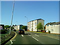
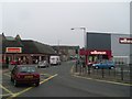
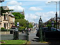
Photos of Kilmarnock


Area Information
Kilmarnock is a substantial town situated in East Ayrshire, Scotland, covering an area of 13.5 square kilometres. It occupies a west-central location within the country, positioned at coordinates 55.609989, -4.482146 within the KA3 7BQ postcode area. The name derives from the Gaelic "Cill Mhearnaig," translating to "Church of St. Marnock," which underscores the town's historic religious significance. A distinct community began forming between the fifth and seventh centuries at Laigh Kirk Church through the work of Saint Marnock. The most recent documented reference to the town dates to the 14th century when the region gained prominence under Clan Boyd. Residents of this location enjoy access to a developed urban environment established by a 1592 charter granted by King James VI. This document confirmed land possession for the Boyd family and created a formal space for craftsmen and traders. Despite facing historical challenges including military occupation and severe fire events, the town expanded significantly during the seventeenth and eighteenth centuries. It ultimately surpassed nearby Kilmaurs to become Ayrshire's largest inland centre. You will find a built-up area that balances historical weight with modern industrial heritage, anchored by the global legacy of the Johnnie Walker whisky brand established in 1820. The provided data does not contain specific demographic statistics regarding age profiles, household composition, or the diversity of the local population in Kilmarnock. While the historical overview notes that the population grew from 6,000 in 1800 to 35,000 by 1901 due to industrial expansion, current household types and demographic breakdowns are not available in the source material. Consequently, any statement regarding the precise age distribution or the proportion of different household types would be speculation rather than a reported fact. Similarly, there is no information available to detail the current accommodation mix beyond the general categorisation of the area as a built-up town. You cannot determine from the available information what percentage of residents own their homes versus rent, nor can you identify specific trends in house ownership levels across the 13.5 square kilometres of the town. The absence of these specific figures means we cannot quantify the social fabric in terms of generational age groups or the split between owner-occupiers and private tenants. Any narrative built on these points would require external data sources not present here. You cannot determine the exact percentage of owner-occupied properties in Kilmarnock from the available information, as the dataset does not specify home ownership rates. The area is classified as a built-up town or city, but the specific breakdown of accommodation types between houses, flats, and bungalows is not detailed in the source data. Therefore, it is impossible to state whether the housing stock consists predominantly of semi-detached houses, terraced properties, or purpose-built apartments. Without a provided home ownership percentage, you cannot assess if this is primarily an area for those buying to live in or if it functions heavily as a rental market. The historical record shows significant population growth linked to industrial manufacturing, suggesting a long history of working-class housing development, but current statistics confirming this trend are absent. Potential buyers looking for data on the prevalence of terraced Victorian homes versus modern developments will not find these specific figures in the current documentation. The character of the housing stock remains undefined by the available quantitative metrics. Digital connectivity in Kilmarnock is very high across both fixed and mobile networks. The fixed broadband score is 97 out of 100, which you should interpret as excellent quality. This high rating means you can expect reliable internet speeds suitable for demanding tasks like streaming in 4K, video conferencing, or large file transfers without significant interruption. For residents working from home, this performance level provides a stable foundation for digital livelihoods. Mobile coverage is also strong, with a score of 83 out of 100. This score represents excellent mobile signal quality across the town. You can rely on clear calls and smooth data transmission whether you are walking around the town centre, visiting Dean Castle, or commuting to nearby stations. Commuters travelling to Glasgow or Irvine will find the connection remains robust even during busy periods. The combination of top-tier broadband and strong mobile signals makes living in Kilmarnock highly convenient for anyone dependent on constant digital access for work or leisure. Residents enjoy immediate access to a variety of retail outlets and transport links within practical reach. You can shop at major retailers such as M&S Kilmarnock, Farmfoods Bonnyton, and Iceland Kilmaru in the local high street. If balance is a concern, Loanhead Public School stands as a Category B listed building, reflecting the area's investment in education. Its foundation stone was laid by Andrew Carnegie in 1903 and opened to pupils the same year. Transport connectivity is supported by three main railway stations: Kilmarnock Railway Station, Kilmaurs Railway Station, and Stewarton Railway Station. These hubs facilitate regular travel to broader regions. The town centre retains historical significance through the Johnnie Walker Bond building, where the globally famous whisky brand was originally produced and bottled since 1820. This industrial heritage is visible alongside modern amenities. You will find a mix of historic landmarks and contemporary services that serve the daily needs of the community living in this active Scottish town. The available safety assessment for Kilmarnock is currently restricted, with crime risk data not available for areas in Scotland under the current reporting framework. Comprehensive crime statistics for this Scottish town are not included in the dataset, meaning specific metrics for violent or non-violent crime levels are absent. Because the system currently only generates crime risk data for areas in England, you cannot obtain a PASS, FAIL, or numerical score for Kilmarnock from this source. Environmental safety or other hazard assessments are also not covered in the provided text. You must rely on general knowledge or separate local council reports for detailed safety information. The datasets provided do not contain risk scores, deprivation indices, or traffic hazard ratings that would allow for a quantitative safety profile. Consequently, you cannot determine the specific safety standing of the area using only the information given. What makes Kilmarnock unique for living?Kilmarnock offers a blend of deep history and modern convenience within a 13.5 square kilometre area. The town features the Category B listed Loanhead Public School and the historic Johnnie Walker Bond building. Residents benefit from an area once described as Ayrshire's largest inland centre, combining industrial heritage with established community facilities. How good is internet and mobile coverage there?Digital connectivity is excellent for working from home. You can expect a broadband score of 97 out of 100 for fixed lines, ensuring high-speed internet for anything from streaming to business calls. Mobile coverage scores 83 out of 100, providing reliable signal throughout the town. What retail and transport options are nearby?Residents have immediate access to key retailers including M&S Kilmarnock, Farmfoods Bonnyton, and Iceland Kilmarnock. Transport is managed through three stations: Kilmarnock, Kilmaurs, and Stewarton Railway Stations. These amenities ensure practical daily life without the need for long travel distances. Is there a risk assessment for crime or safety data?No specific crime risk data is available for Kilmarnock in the current dataset. The system only provides crime risk assessments for areas in England. Therefore, you cannot find a PASS or FAIL rating, or specific crime figures, for this Scottish town within the provided information. Who is the typical resident and what is the community like?The data does not provide specific figures on age, household types, or diversity. However, the town has a documented history of population growth from 6,000 in 1800 to 35,000 by 1901 due to manufacturing. It remains a built-up town with a legacy tied to industries like leather work and whisky production.
- Area Type
- Built Up Area 250
- Area Size
- 13.5 km²
- Population
- Not available
- Population Density
- Not available
Residents enjoy immediate access to a variety of retail outlets and transport links within practical reach. You can shop at major retailers such as M&S Kilmarnock, Farmfoods Bonnyton, and Iceland Kilmaru in the local high street. If balance is a concern, Loanhead Public School stands as a Category B listed building, reflecting the area's investment in education. Its foundation stone was laid by Andrew Carnegie in 1903 and opened to pupils the same year. Transport connectivity is supported by three main railway stations: Kilmarnock Railway Station, Kilmaurs Railway Station, and Stewarton Railway Station. These hubs facilitate regular travel to broader regions. The town centre retains historical significance through the Johnnie Walker Bond building, where the globally famous whisky brand was originally produced and bottled since 1820. This industrial heritage is visible alongside modern amenities. You will find a mix of historic landmarks and contemporary services that serve the daily needs of the community living in this active Scottish town. The available safety assessment for Kilmarnock is currently restricted, with crime risk data not available for areas in Scotland under the current reporting framework. Comprehensive crime statistics for this Scottish town are not included in the dataset, meaning specific metrics for violent or non-violent crime levels are absent. Because the system currently only generates crime risk data for areas in England, you cannot obtain a PASS, FAIL, or numerical score for Kilmarnock from this source. Environmental safety or other hazard assessments are also not covered in the provided text. You must rely on general knowledge or separate local council reports for detailed safety information. The datasets provided do not contain risk scores, deprivation indices, or traffic hazard ratings that would allow for a quantitative safety profile. Consequently, you cannot determine the specific safety standing of the area using only the information given. What makes Kilmarnock unique for living?Kilmarnock offers a blend of deep history and modern convenience within a 13.5 square kilometre area. The town features the Category B listed Loanhead Public School and the historic Johnnie Walker Bond building. Residents benefit from an area once described as Ayrshire's largest inland centre, combining industrial heritage with established community facilities. How good is internet and mobile coverage there?Digital connectivity is excellent for working from home. You can expect a broadband score of 97 out of 100 for fixed lines, ensuring high-speed internet for anything from streaming to business calls. Mobile coverage scores 83 out of 100, providing reliable signal throughout the town. What retail and transport options are nearby?Residents have immediate access to key retailers including M&S Kilmarnock, Farmfoods Bonnyton, and Iceland Kilmarnock. Transport is managed through three stations: Kilmarnock, Kilmaurs, and Stewarton Railway Stations. These amenities ensure practical daily life without the need for long travel distances. Is there a risk assessment for crime or safety data?No specific crime risk data is available for Kilmarnock in the current dataset. The system only provides crime risk assessments for areas in England. Therefore, you cannot find a PASS or FAIL rating, or specific crime figures, for this Scottish town within the provided information. Who is the typical resident and what is the community like?The data does not provide specific figures on age, household types, or diversity. However, the town has a documented history of population growth from 6,000 in 1800 to 35,000 by 1901 due to manufacturing. It remains a built-up town with a legacy tied to industries like leather work and whisky production.
Amenities
Schools
| Rank | School | Type | Entry gender | Ages |
|---|
Explore more schools in this area
Go to Schools tabDemographics
The provided data does not contain specific demographic statistics regarding age profiles, household composition, or the diversity of the local population in Kilmarnock. While the historical overview notes that the population grew from 6,000 in 1800 to 35,000 by 1901 due to industrial expansion, current household types and demographic breakdowns are not available in the source material. Consequently, any statement regarding the precise age distribution or the proportion of different household types would be speculation rather than a reported fact. Similarly, there is no information available to detail the current accommodation mix beyond the general categorisation of the area as a built-up town. You cannot determine from the available information what percentage of residents own their homes versus rent, nor can you identify specific trends in house ownership levels across the 13.5 square kilometres of the town. The absence of these specific figures means we cannot quantify the social fabric in terms of generational age groups or the split between owner-occupiers and private tenants. Any narrative built on these points would require external data sources not present here. You cannot determine the exact percentage of owner-occupied properties in Kilmarnock from the available information, as the dataset does not specify home ownership rates. The area is classified as a built-up town or city, but the specific breakdown of accommodation types between houses, flats, and bungalows is not detailed in the source data. Therefore, it is impossible to state whether the housing stock consists predominantly of semi-detached houses, terraced properties, or purpose-built apartments. Without a provided home ownership percentage, you cannot assess if this is primarily an area for those buying to live in or if it functions heavily as a rental market. The historical record shows significant population growth linked to industrial manufacturing, suggesting a long history of working-class housing development, but current statistics confirming this trend are absent. Potential buyers looking for data on the prevalence of terraced Victorian homes versus modern developments will not find these specific figures in the current documentation. The character of the housing stock remains undefined by the available quantitative metrics. Digital connectivity in Kilmarnock is very high across both fixed and mobile networks. The fixed broadband score is 97 out of 100, which you should interpret as excellent quality. This high rating means you can expect reliable internet speeds suitable for demanding tasks like streaming in 4K, video conferencing, or large file transfers without significant interruption. For residents working from home, this performance level provides a stable foundation for digital livelihoods. Mobile coverage is also strong, with a score of 83 out of 100. This score represents excellent mobile signal quality across the town. You can rely on clear calls and smooth data transmission whether you are walking around the town centre, visiting Dean Castle, or commuting to nearby stations. Commuters travelling to Glasgow or Irvine will find the connection remains robust even during busy periods. The combination of top-tier broadband and strong mobile signals makes living in Kilmarnock highly convenient for anyone dependent on constant digital access for work or leisure. Residents enjoy immediate access to a variety of retail outlets and transport links within practical reach. You can shop at major retailers such as M&S Kilmarnock, Farmfoods Bonnyton, and Iceland Kilmaru in the local high street. If balance is a concern, Loanhead Public School stands as a Category B listed building, reflecting the area's investment in education. Its foundation stone was laid by Andrew Carnegie in 1903 and opened to pupils the same year. Transport connectivity is supported by three main railway stations: Kilmarnock Railway Station, Kilmaurs Railway Station, and Stewarton Railway Station. These hubs facilitate regular travel to broader regions. The town centre retains historical significance through the Johnnie Walker Bond building, where the globally famous whisky brand was originally produced and bottled since 1820. This industrial heritage is visible alongside modern amenities. You will find a mix of historic landmarks and contemporary services that serve the daily needs of the community living in this active Scottish town. The available safety assessment for Kilmarnock is currently restricted, with crime risk data not available for areas in Scotland under the current reporting framework. Comprehensive crime statistics for this Scottish town are not included in the dataset, meaning specific metrics for violent or non-violent crime levels are absent. Because the system currently only generates crime risk data for areas in England, you cannot obtain a PASS, FAIL, or numerical score for Kilmarnock from this source. Environmental safety or other hazard assessments are also not covered in the provided text. You must rely on general knowledge or separate local council reports for detailed safety information. The datasets provided do not contain risk scores, deprivation indices, or traffic hazard ratings that would allow for a quantitative safety profile. Consequently, you cannot determine the specific safety standing of the area using only the information given. What makes Kilmarnock unique for living?Kilmarnock offers a blend of deep history and modern convenience within a 13.5 square kilometre area. The town features the Category B listed Loanhead Public School and the historic Johnnie Walker Bond building. Residents benefit from an area once described as Ayrshire's largest inland centre, combining industrial heritage with established community facilities. How good is internet and mobile coverage there?Digital connectivity is excellent for working from home. You can expect a broadband score of 97 out of 100 for fixed lines, ensuring high-speed internet for anything from streaming to business calls. Mobile coverage scores 83 out of 100, providing reliable signal throughout the town. What retail and transport options are nearby?Residents have immediate access to key retailers including M&S Kilmarnock, Farmfoods Bonnyton, and Iceland Kilmarnock. Transport is managed through three stations: Kilmarnock, Kilmaurs, and Stewarton Railway Stations. These amenities ensure practical daily life without the need for long travel distances. Is there a risk assessment for crime or safety data?No specific crime risk data is available for Kilmarnock in the current dataset. The system only provides crime risk assessments for areas in England. Therefore, you cannot find a PASS or FAIL rating, or specific crime figures, for this Scottish town within the provided information. Who is the typical resident and what is the community like?The data does not provide specific figures on age, household types, or diversity. However, the town has a documented history of population growth from 6,000 in 1800 to 35,000 by 1901 due to manufacturing. It remains a built-up town with a legacy tied to industries like leather work and whisky production.
Household Size
Accommodation Type
Tenure
Ethnic Group
Religion
Household Composition
Age
Household Deprivation
NS-SEC
Explore more demographic insights in this area
Go to Demographics tabPlanning
Planning Constraints
- Crime RiskPremium