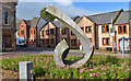
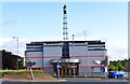
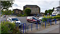
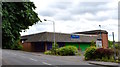
Area Overview for Kilbirnie
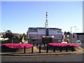
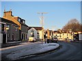
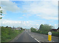
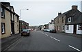
Photos of Kilbirnie


Area Information
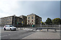
Kilbirnie stands as a distinct built-up area within South Ayrshire, covering a total landmass of 1.8 square kilometres. Residents here experience life in a compact setting where daily necessities are often within a short drive or walk. The area functions as an established residential hub rather than a sprawling expansion. Because the geographical footprint is relatively small, you move through the neighbourhood quickly, allowing for easy access between home, local shops, and transport links. The community benefits from its proximity to larger town centres while maintaining its own identity. Living in Kilbirnie means navigating a defined urban space where Little Kilbirnie and the surrounding streets form a cohesive environment. You will find that the scale of the area supports a manageable pace of life, contrasting with the traffic-heavy routes found further out on the motorway network. The 1.8 km² limit defines the character of the place, ensuring that the journey from your front door to local amenities remains practical for commuters and families alike.
- Area Type
- Built Up Area 250
- Area Size
- 1.8 km²
- Population
- Not available
- Population Density
- Not available
Your leisure time in Kilbirnie is supported by a cluster of amenities within practical reach. The retail landscape includes Tesco Kilbirnie, which provides essential groceries and general merchandise, alongside Co-op stores located in both Beith and Dalry. These supermarkets are a short drive away, ensuring you have reliable options for shopping without needing to travel far. For those who prefer trains, three railway stations serve the region efficiently: Glengarnock, Dalry, and Lochwinnoch. These stations offer direct links to bigger cities like Glasgow and Kilmarnock, fitting perfectly into a busy commute routine. Living in Kilbirnie means you balance local convenience with the speed of rail travel. The area does not boast a vast array of restaurants or major leisure centres within its immediate 1.8 km² boundary, so you rely on the nearby towns for dining andCulture. Yet, the proximity of the railway and the main Tesco makes the location highly functional for daily life. You can start the day locally and travel great distances in under an hour by train.
Amenities
Schools
| Rank | School | Type | Entry gender | Ages |
|---|
Explore more schools in this area
Go to Schools tabDemographics
Your understanding of the people living in Kilbirnie helps you gauge the community fit. The provided data outlines specific characteristics of the housing and residents but does not include detailed statistics on age profiles, household sizes, or diversity indices. Consequently, you cannot determine the exact percentage of young families or elderly residents based on the current information. Instead, you must look to the housing structure to infer the nature of the community. The area contains a mix of accommodation types that support various lifestyles, though the precise breakdown of private versus social homes is not detailed in the source figures. You should note that deprivation data is also absent from the records, so you cannot assess living standards through official metrics. If you are researching homes in Kilbirnie, focus on the fact that the area is established and populated, but specific demographic nuances remain outside the scope of the available documentation.
Household Size
Accommodation Type
Tenure
Ethnic Group
Religion
Household Composition
Age
Household Deprivation
NS-SEC
Explore more demographic insights in this area
Go to Demographics tabPlanning
Planning Constraints
- Crime RiskPremium