Area Overview for KA6 7RF
Photos of KA6 7RF
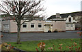
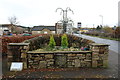
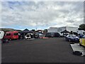
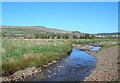
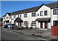
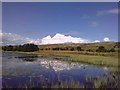
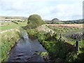
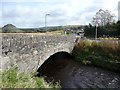
23 photos from this area
Area Information
Key information about the KA6 7RF including its size, population, and administrative classification.
- Area Type
- Postcode
- Area Size
- 4.3 hectares
- Population
- Not available
- Population Density
- Not available
House Prices in KA6 7RF
22
Properties
-
Average Sold Price
-
Lowest Price
-
Highest Price
Showing 22 properties
| Address | Type | Beds | Baths | Last Sale Price | Last Sale Date | |
|---|---|---|---|---|---|---|
| 12 Armour Wynd, Dalmellington, KA6 7RF | Bungalow | 3 | 2 | - | - | |
| 10 Armour Wynd, Dalmellington, KA6 7RF | Bungalow | 3 | 1 | - | - | |
| 1 Armour Wynd, Dalmellington, KA6 7RF | Detached | 4 | 4 | - | - | |
| 5 Armour Wynd, Dalmellington, KA6 7RF | Detached | 3 | 2 | - | - | |
| 6 Armour Wynd, Dalmellington, KA6 7RF | Bungalow | 5 | 4 | - | - | |
| 3 Armour Wynd, Dalmellington, KA6 7RF | Detached | 3 | 2 | - | - | |
| 9 Armour Wynd, Dalmellington, KA6 7RF | Bungalow | 3 | 1 | - | - | |
| 14 Armour Wynd, Dalmellington, KA6 7RF | Semi-detached | 3 | - | - | - | |
| 15 Armour Wynd, Dalmellington, KA6 7RF | Semi-detached | 3 | - | - | - | |
| Glencaple, 7 Armour Wynd, Dalmellington, KA6 7RF | Detached | - | - | - | - |
Page 1 of 3
Energy Efficiency in KA6 7RF
Amenities
Schools
| Rank | School | Type | Entry gender | Ages |
|---|
Explore more schools in this area
Go to Schools tabDemographics
Household Size
N/A
most common
Accommodation Type
N/A
most common
Tenure
N/A
majority
Ethnic Group
N/A
most common
Religion
N/A
most common
Household Composition
N/A
most common
Age
N/A
median
N/A
most common
Household Deprivation
N/A
with no deprivation
NS-SEC
N/A
in Lower managerial occupations
Explore more demographic insights in this area
Go to Demographics tabPlanning
Planning Constraints
- Flood RiskPremium
- Ramsar Wetland SitesPremium
- Area of Outstanding Natural BeautyPremium
- Protected Nature ReservePremium
- Protected WoodlandPremium
- Crime RiskPremium