Area Overview for KA6 6ED
Photos of KA6 6ED


Area Information
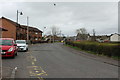
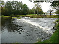
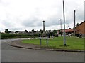
KA6 6ED is a small residential postcode in Scotland, encompassing a compact cluster of homes nestled near the towns of Ayr and Maybole. This area is defined by its proximity to practical amenities, including rail stations, ferry services, and local shops, making it a convenient choice for those seeking a mix of rural tranquillity and accessible urban infrastructure. The area’s low flood risk and absence of environmental constraints like protected woodlands or nature reserves suggest a stable, low-maintenance living environment. Residents benefit from nearby rail links to Ayr and Maybole, with Newton also within reach, offering connections to larger towns. The postcode’s small size means it is likely to have a tight-knit community, with daily life revolving around local retail spots like Spar and Iceland Maybole. While broadband connectivity is limited—scoring 29 out of 100—mobile coverage is strong, with a score of 83, ensuring reliable communication for most purposes. For buyers, KA6 6ED presents a blend of practicality and simplicity, ideal for those prioritising safety, ease of access, and a low-risk lifestyle.
- Area Type
- Postcode
- Area Size
- Not available
- Population
- Not available
- Population Density
- Not available
The property market in KA6 6ED reflects its small, residential nature, with a focus on owner-occupied homes. While specific ownership percentages are not provided, the area’s compact size suggests a limited housing stock, likely dominated by single-family homes or small terraced properties. The absence of large-scale developments or rental-focused schemes indicates this is not a high-turnover area, appealing to buyers seeking long-term stability. Proximity to rail and ferry services may attract commuters or those seeking a balance between rural living and connectivity to nearby towns. However, the limited broadband infrastructure could be a consideration for remote workers, though mobile coverage mitigates this to an extent. For buyers, the area’s small footprint means properties are likely to be in close proximity to each other, with limited scope for expansion. This makes it a niche market, suited to those valuing a quiet, low-maintenance lifestyle over extensive property choice.
House Prices in KA6 6ED
No properties found in this postcode.
Energy Efficiency in KA6 6ED
Residents of KA6 6ED have access to a range of nearby amenities that support a practical, community-focused lifestyle. The area’s retail options include Spar and Iceland Maybole, providing essential shopping for daily needs. Rail stations at Ayr, Maybole, and Newton offer easy access to regional hubs, while the Ayr Compass Pier ferry service connects to coastal destinations. Though the area is small, these amenities contribute to a self-contained living experience, reducing the need for long commutes. The absence of large-scale leisure facilities or parks suggests that outdoor recreation may be more limited to nearby natural areas. However, the proximity to rail and ferry services ensures that residents can easily reach larger towns for cultural or entertainment opportunities. This balance of local convenience and regional connectivity makes KA6 6ED suitable for those valuing accessibility without sacrificing a quiet, residential environment.
Amenities
Schools
| Rank | School | Type | Entry gender | Ages |
|---|
Explore more schools in this area
Go to Schools tabDemographics
Household Size
Accommodation Type
Tenure
Ethnic Group
Religion
Household Composition
Age
Household Deprivation
NS-SEC
Explore more demographic insights in this area
Go to Demographics tabPlanning
Planning Constraints
- Flood RiskPremium
- Ramsar Wetland SitesPremium
- Area of Outstanding Natural BeautyPremium
- Protected Nature ReservePremium
- Protected WoodlandPremium
- Crime RiskPremium