Area Overview for KA26 0LE
Photos of KA26 0LE

Area Information
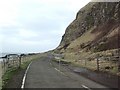
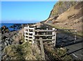
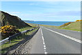
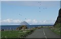
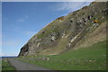
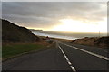
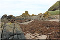
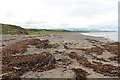
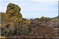
KA26 0LE identifies a specific residential cluster within North Ayrshire, Scotland. This postcode covers an area size of 1.7 km², situated on the west coast along the shore of the Firth of Clyde. The location falls under the broader lieutenancy area of Ayrshire and Arran, a region branded as a tourist destination that encompasses both coastal settlements and island communities. Residents live in a small community defined by its precise geographical boundaries rather than a sprawling urban sprawl. The coordinates place it firmly within the historic county of Ayrshire, an area separated by the Kintyre peninsula from the culturally similar Hebrides. You are living in an environment where local government reorganisation in 1996 established the modern structure you are now part of. This area is distinct from the mythology-laden bigger towns, offering a contained lifestyle within the larger North Ayrshire unitary council area. Daily life here is shaped by these clear geographical limits and the rich heritage of the region, which stretches from the Neolithic age through Roman invasion to the present day.
- Area Type
- Postcode
- Area Size
- 1.7 km²
- Population
- Not available
- Population Density
- Not available
The specific characteristics of the housing stock in KA26 0LE are not detailed in the current dataset. There are no figures available to indicate the percentage of owner-occupied homes versus those in the rental sector. We do not know if the property market in this postcode is primarily driven by first-time buyers or downsizers. The imbalance in the digital connectivity data suggests a potential challenge for modern property needs. Broadband quality scores indicate a fixed broadband score of 56 out of 100. This lower connectivity index may impact your ability to work from home reliably if you are considering a property here. Conversely, mobile coverage scores are higher at 83 out of 100, which could support expectations for mobile internet usage in pockets without fixed lines. However, without explicit data on the types of dwellings or price trends, we cannot describe whether this area features predominantly detached houses, terraced flats, or a mix. The lack of specific accommodation data means you must rely on external valuation sites to gauge the current market value of homes in this small residential cluster before committing to a purchase.
House Prices in KA26 0LE
Showing 5 properties
Energy Efficiency in KA26 0LE
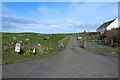
A day in KA26 0LE is shaped by practical amenities within easy reach. You have access to a single major retail venue, the Co-op Ballantrae. This store serves as the primary hub for your daily shopping needs. Beyond essential retail, there are no other notable facilities listed within the practical reach of this postcode. The lack of specific named schools, parks, or leisure centres in the immediate vicinity means you will need to travel further for these services. You might find that school searches require looking beyond the immediate 1.7 km² boundary. The area relies heavily on the Co-op Ballantrae for its residential character. While the region of Ayrshire and Arran is known for coastal attractions, the specific postcode does not appear to have these amenities listed as being within practical reach. Your lifestyle here centres on the convenience of the Co-op and the quiet of a small residential cluster far from the main tourist hubs of Ayr or the Isle of Arran.
Amenities
Schools
| Rank | School | Type | Entry gender | Ages |
|---|
Explore more schools in this area
Go to Schools tabDemographics
There are no specific demographic figures provided for the population, age profile, or household types within the KA26 0LE postcode. Without data on deprivation levels, we cannot quantify the quality of life or compare living standards to other Scots. We do not know the breakdown of home ownership versus social renting in this specific cluster. Information on the diversity of the community or the mix of accommodation types is absent from the available records. Because the dataset does not include statistics on these key community indicators, a detailed profile of who calls this 1.7 km² home remains incomplete. You cannot verify the age distribution or the ratio of flats to houses based on the current information. Similarly, there is no data available to describe the economic makeup of the residents or their access to public transport. The only firm fact regarding the community's statistics is the total land area. Further research into local council records or census data would be necessary to construct a full demographic picture for prospective buyers seeking specific population data.
Household Size
Accommodation Type
Tenure
Ethnic Group
Religion
Household Composition
Age
Household Deprivation
NS-SEC
Explore more demographic insights in this area
Go to Demographics tabPlanning
Planning Constraints
- Flood RiskPremium
- Ramsar Wetland SitesPremium
- Area of Outstanding Natural BeautyPremium
- Protected Nature ReservePremium
- Protected WoodlandPremium
- Crime RiskPremium