Area Overview for KA23 9HF
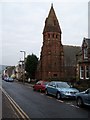
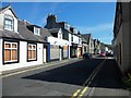
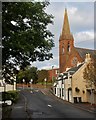
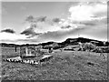
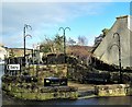
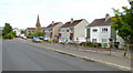
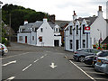
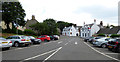
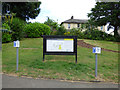
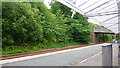
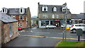
Photos of KA23 9HF

Area Information
KA23 9HF is a small, tightly packed residential area in Scotland, spanning just 1.0 hectare. Its compact size means it is likely a close-knit community with a strong local identity. The area is well-connected by rail, with stations such as West Kilbride, Ardrossan Harbour, and Fairlie within practical reach, offering regular links to nearby towns. Ferry services are also accessible, with terminals at Fairlie, Ardrossan, and Millport Pier, providing routes across the Firth of Clyde. This makes KA23 9HF a convenient base for those who rely on maritime travel. The area has no flood risk, and there are no protected natural sites nearby, such as Ramsar wetlands or Areas of Outstanding Natural Beauty. This absence of environmental constraints may appeal to buyers seeking straightforward development potential. The proximity to multiple retail outlets, including Co-op West, Spar, and Morrisons Daily, suggests a practical daily life with easy access to essentials. While the area is small, its infrastructure and connectivity position it as a viable option for those prioritising convenience and accessibility.
- Area Type
- Postcode
- Area Size
- 1.0 hectares
- Population
- Not available
- Population Density
- Not available
House Prices in KA23 9HF
Showing 42 properties
| Address | Type | Beds | Baths | Last Sale Price | Last Sale Date | |
|---|---|---|---|---|---|---|
| 47 Ritchie Street, West Kilbride, KA23 9HF | Semi-detached | 3 | 2 | - | - | |
| 43 Ritchie Street, West Kilbride, KA23 9HF | Flat | 1 | 1 | - | - | |
| 54 Ritchie Street, West Kilbride, KA23 9HF | Detached | 3 | - | - | - | |
| 44 Ritchie Street, West Kilbride, KA23 9HF | Semi-detached | 4 | - | - | - | |
| 55 Ritchie Street, West Kilbride, KA23 9HF | Semi-detached | 4 | - | - | - | |
| 49 Ritchie Street, West Kilbride, KA23 9HF | Semi-detached | 3 | - | - | - | |
| 36 Ritchie Street, West Kilbride, KA23 9HF | Flat | 4 | - | - | - | |
| 42 Ritchie Street, West Kilbride, KA23 9HF | Terraced | 2 | - | - | - | |
| Caretakers Flat, 50 Ritchie Street, West Kilbride, KA23 9HF | Flat | - | - | - | - | |
| 37 Ritchie Street, West Kilbride, KA23 9HF | retail_financial | - | - | - | - |
Energy Efficiency in KA23 9HF
Daily life in KA23 9HF is shaped by its proximity to retail, transport, and coastal amenities. The area’s five retail outlets, including Co-op West and Morrisons Daily, provide convenient access to groceries and everyday essentials. For those who enjoy travel, the nearby rail stations and ferry terminals open up opportunities for commuting, weekend excursions, or exploring the surrounding countryside. The absence of major natural constraints means the area is not encumbered by protected landscapes, which could simplify local development or leisure activities. The small size of KA23 9HF means its amenities are tightly clustered, reducing the need for long commutes. Residents can walk or cycle to nearby shops, stations, and ferry points, fostering a practical, low-stress lifestyle. While the area lacks large-scale leisure facilities, its coastal proximity and rail links offer alternative recreational options. Overall, KA23 9HF caters to those who value convenience, connectivity, and a compact living environment.
Amenities
Schools
| Rank | School | Type | Entry gender | Ages |
|---|
Explore more schools in this area
Go to Schools tabDemographics
Household Size
Accommodation Type
Tenure
Ethnic Group
Religion
Household Composition
Age
Household Deprivation
NS-SEC
Explore more demographic insights in this area
Go to Demographics tabPlanning
Planning Constraints
- Flood RiskPremium
- Ramsar Wetland SitesPremium
- Area of Outstanding Natural BeautyPremium
- Protected Nature ReservePremium
- Protected WoodlandPremium
- Crime & SafetyPremium