Area Overview for KA18 4QN
Photos of KA18 4QN

Area Information
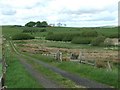
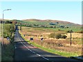
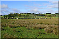
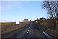
The postcode KA18 4QN represents a small residential cluster situated within the lieutenancy area of Ayrshire and Arran. This specific location covers an area of 4.0 hectares and sits firmly within the North Ayrshire council region, which includes the Isle of Arran. The coordinates 55.62216, -4.473588 place this homes in KA18 4QN along the west coast of Scotland, bordering the Firth of Clyde. While the modern lieutenancy area of Ayrshire and Arran was formally created in 1996, residents here benefit from a landscape shaped by history stretching from the Neolithic age through Roman invasion. The region encompasses both coastal settlements and island communities, offering a setting that values natural heritage and local history. Living in KA18 4QN means residing in a defined space that connects to the wider cultural narrative of the county, from the birthplace of Robert Burns in Alloway to the geological diversity of the nearby Arran. Daily life here is grounded in a community embedded within the traditional districts that once divided the historic county of Ayrshire into Cunninghame, Kyle, and Carrick. You are buying into a specific postcode area that serves as a gateway to the broader geographical and historical fabric of North Ayrshire.
- Area Type
- Postcode
- Area Size
- 4.0 hectares
- Population
- Not available
- Population Density
- Not available
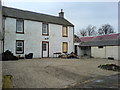
The specific breakdown of home ownership percentages and the detailed accommodation types within KA18 4QN are not reflected in the current property data provided for this postcode. Because these critical market indicators are absent, it is impossible to state whether this scarce cluster of living space is predominantly owner-occupied or dominated by rental properties. Buyers seeking to understand the balance of detached homes, flats, or bungalows in this 4.0 hectare area must rely on future updates to the comprehensive housing stock analysis. The description of the area as a small residential cluster suggests a limited number of distinct properties, yet the exact configuration of the housing stock remains undocumented in the available records. Without figures on the proportion of social housing versus private ownership, potential purchasers cannot accurately gauge the established nature of the streets or the prevalence of inheritance properties versus new builds. The missing data on accommodation types prevents a clear assessment of whether the area suits young professionals, retirees, or families looking for specific layouts. Consequently, the market character of KA18 4QN remains defined by its physical location rather than by statistical evidence of occupancy patterns until more complete property datasets are published.
House Prices in KA18 4QN
Showing 7 properties
| Address | Type | Beds | Baths | Last Sale Price | Last Sale Date | |
|---|---|---|---|---|---|---|
| Mosswood, 1 Burnside, New Cumnock, KA18 4QN | Bungalow | 4 | - | - | - | |
| Shiloh, Burnside, New Cumnock, KA18 4QN | Detached | - | - | - | - | |
| 48, Burnside, Burnside, New Cumnock, KA18 4QN | Semi-detached | - | - | - | - | |
| 49, Burnside, Burnside, New Cumnock, KA18 4QN | Semi-detached | - | - | - | - | |
| Blarene, Burnside, New Cumnock, KA18 4QN | Detached | - | - | - | - | |
| Polgaw Bungalow, Burnside, New Cumnock, KA18 4QN | Detached | - | - | - | - | |
| Mosswood, 2 Burnside, New Cumnock, KA18 4QN | Bungalow | - | - | - | - |
Energy Efficiency in KA18 4QN
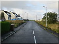
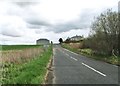
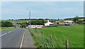
Residents of KA18 4QN enjoy practical access to essential retail and transport hubs within a short driving distance. The nearby amenities list includes five key retail outlets, specifically the Co-op New, Asda Cumnock, and the Co-op Cumnock. These venues provide a straightforward option for daily groceries and shopping needs, ensuring that routine errands do not require a long journey. Beyond retail, the area benefits from proximity to public transport, with one station identified as the New Cumnock Railway Station. This rail link offers a direct connection to the wider network, facilitating commutes to larger towns or employment centres outside the immediate vicinity. The neighbourhood is characterised by its functional convenience rather than a high concentration of leisure facilities within the immediate cluster. While the living in KA18 4QN experience relies on the wider reach of Cumnock for dining and entertainment, the presence of these specific named shops and the railway station provides a solid foundation for daily life. You do not need to worry about basic necessities, as the combination of multiple retail options and rail access ensures that essential services remain within practical reach of every address. This connectivity supports a lifestyle where local shopping is efficient without the need for extensive travel plans.
Amenities
Schools
| Rank | School | Type | Entry gender | Ages |
|---|
Explore more schools in this area
Go to Schools tabDemographics
Detailed demographic statistics covering age profiles, household types, deprivation levels, and minority ethnic populations are not included in the current information for this postcode. Consequently, it is difficult to construct a precise picture of the specific age distribution or the balance between family homes and single-person households within KA18 4QN without further statistical breakdown. The absence of granular data on social metrics means that assertions regarding the diversity of the population or the extent of home ownership must await release of more comprehensive census figures for this micro-location. While the wider North Ayrshire context involves a mix of urban and rural living, the specific community makeup of this 4.0 hectare cluster remains undefined in the available records. Homebuyers looking for hard data on income inequality, unemployment rates, or the specific ratio of renters to owners within this immediate vicinity will need to consult primary census sources. The lack of visible figures on these key indicators suggests that while the physical space is well-defined by its boundaries, the detailed sociological profile is currently unavailable for public review. Any claims about who lives here would be purely speculative without access to the underlying registry or census data that formally captures these residential profiles.
Household Size
Accommodation Type
Tenure
Ethnic Group
Religion
Household Composition
Age
Household Deprivation
NS-SEC
Explore more demographic insights in this area
Go to Demographics tabPlanning
Planning Constraints
- Flood RiskPremium
- Ramsar Wetland SitesPremium
- Area of Outstanding Natural BeautyPremium
- Protected Nature ReservePremium
- Protected WoodlandPremium
- Crime RiskPremium