Area Overview for KA18 2RF
Photos of KA18 2RF
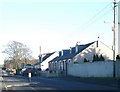
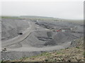
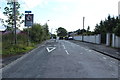
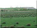
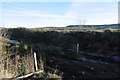
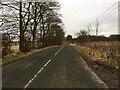
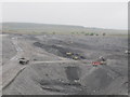
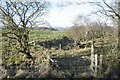
9 photos from this area
Area Information
Key information about the KA18 2RF including its size, population, and administrative classification.
- Area Type
- Postcode
- Area Size
- 54.2 hectares
- Population
- Not available
- Population Density
- Not available
House Prices in KA18 2RF
33
Properties
-
Average Sold Price
-
Lowest Price
-
Highest Price
Showing 33 properties
| Address | Type | Beds | Baths | Last Sale Price | Last Sale Date | |
|---|---|---|---|---|---|---|
| 3 George Terrace, Skares, KA18 2RF | Bungalow | 3 | - | - | - | |
| 1, The Auld Hoose, Hindsward, Skares Road, Cumnock, KA18 2RF | undefined | - | - | - | - | |
| 3, The Barn, Hindsward, Skares Road, Cumnock, KA18 2RF | undefined | - | - | - | - | |
| 2, The Byre, Hindsward, Skares Road, Cumnock, KA18 2RF | undefined | - | - | - | - | |
| Skares Cottage 4, 4 Skares Road, Cumnock, KA18 2RF | Terraced | - | - | - | - | |
| Skares Cottage, 3 Skares Road, Cumnock, KA18 2RF | Terraced | - | - | - | - | |
| Hindsward, Skares Road, Cumnock, KA18 2RF | undefined | - | - | - | - | |
| Whitesmuir Caravan, Whitesmuir, Skares Road, Cumnock, KA18 2RF | Mobile Home | - | - | - | - | |
| Whitesmuir Farmhouse, Whitesmuir, Skares Road, Cumnock, KA18 2RF | Detached | - | - | - | - | |
| Met Mast Location, B 741 From Armour Wynd To U 720 Dalricket, Dalmellington, KA18 2RF | Industrial | - | - | - | - |
Page 1 of 4
Energy Efficiency in KA18 2RF
Amenities
Schools
| Rank | School | Type | Entry gender | Ages |
|---|
Explore more schools in this area
Go to Schools tabDemographics
Household Size
N/A
most common
Accommodation Type
N/A
most common
Tenure
N/A
majority
Ethnic Group
N/A
most common
Religion
N/A
most common
Household Composition
N/A
most common
Age
N/A
median
N/A
most common
Household Deprivation
N/A
with no deprivation
NS-SEC
N/A
in Lower managerial occupations
Explore more demographic insights in this area
Go to Demographics tabPlanning
Planning Constraints
- Flood RiskPremium
- Ramsar Wetland SitesPremium
- Area of Outstanding Natural BeautyPremium
- Protected Nature ReservePremium
- Protected WoodlandPremium
- Crime RiskPremium