Area Overview for KA17 0AZ
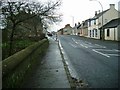
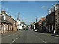
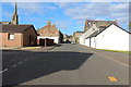
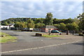
Photos of KA17 0AZ


Area Information
KA17 0AZ is a small residential postcode in Scotland, encompassing a tightly knit cluster of homes. Its compact size means it’s ideal for those seeking a quiet, community-focused environment without the sprawl of larger towns. The area is well-served by digital connectivity, with a broadband score of 90 and mobile coverage of 83, both indicating excellent performance. This makes it suitable for remote workers or those who rely on high-speed internet for daily tasks. The surrounding area includes three notable retail spots, such as Co-op Darvel and Tesco Galston, offering convenience for everyday shopping. While the postcode is small, it benefits from low flood risk and no proximity to protected natural sites, ensuring minimal environmental constraints. The area’s appeal lies in its balance of practicality and tranquillity, with easy access to nearby amenities without the hustle of urban centres. It’s a place where daily life is shaped by local shops, reliable connectivity, and a sense of security from low-risk assessments. For buyers seeking a compact, well-connected home with a focus on safety and convenience, KA17 0AZ presents a compelling option.
- Area Type
- Postcode
- Area Size
- Not available
- Population
- Not available
- Population Density
- Not available
The property market in KA17 0AZ reflects a mix of home ownership and rental activity, though exact figures on ownership percentages are not specified. The area’s small size suggests a limited but distinct housing stock, likely comprising a range of accommodation types. Given the absence of large-scale developments, properties here may be more individualised, with fewer high-density options. This makes the area appealing to buyers seeking a quieter, more personal living environment. The lack of planning constraints, such as protected woodlands or AONB designations, means development is not restricted, potentially offering flexibility for future buyers. However, the small postcode size means the market is tightly bound to local demand, with limited scope for expansion. For those considering a purchase, the focus should be on the specific characteristics of individual properties, as the overall market is not defined by broad trends. The area’s proximity to retail and transport infrastructure adds practical value, though buyers should assess how well individual homes align with their needs.
House Prices in KA17 0AZ
No properties found in this postcode.
Energy Efficiency in KA17 0AZ
Living in KA17 0AZ offers access to a selection of nearby amenities, including three retail outlets such as Co-op Darvel, Tesco Galston, and Co-op Galston. These provide essential shopping options for groceries, household items, and other daily needs. While the area is small, the proximity of these venues ensures convenience for residents, reducing the need for long journeys to larger centres. The absence of detailed data on dining, parks, or leisure facilities means the full range of lifestyle options is not specified, but the retail presence suggests a functional, community-oriented environment. For those who value local shops and easy access to essentials, KA17 0AZ delivers practicality. The character of the area is likely shaped by its compact size and the availability of nearby services, creating a self-contained yet connected living experience.
Amenities
Schools
| Rank | School | Type | Entry gender | Ages |
|---|
Explore more schools in this area
Go to Schools tabDemographics
Household Size
Accommodation Type
Tenure
Ethnic Group
Religion
Household Composition
Age
Household Deprivation
NS-SEC
Explore more demographic insights in this area
Go to Demographics tabPlanning
Planning Constraints
- Flood RiskPremium
- Ramsar Wetland SitesPremium
- Area of Outstanding Natural BeautyPremium
- Protected Nature ReservePremium
- Protected WoodlandPremium
- Crime RiskPremium