Area Overview for KA11 4NY
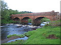
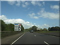
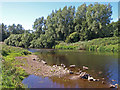
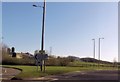
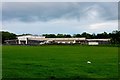
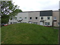
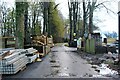
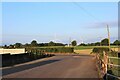
Photos of KA11 4NY


Area Information
KA11 4NY is a small residential postcode area in Scotland, encompassing a tight-knit cluster of homes. Its compact nature means residents share proximity to local amenities and natural surroundings. The area benefits from excellent broadband connectivity, with a score of 100 — the highest possible — ensuring seamless online access for work, education, or leisure. Nearby, practical transport links include multiple railway stations, such as Irvine and Barassie, offering regular services to larger towns. A ferry terminal at Troon adds maritime connectivity, though it is a short distance away. The area’s low flood risk and absence of protected natural sites suggest a stable, low-constraint environment for development. Daily life here balances convenience with tranquillity, with small shops like Co-op Dreghorn and Spar within reach. While the population size is not specified, the area’s character is defined by its accessibility and the blend of rural and commuter-friendly features. For those seeking a quiet yet connected Scottish postcode, KA11 4NY offers a straightforward, practical living experience.
- Area Type
- Postcode
- Area Size
- Not available
- Population
- Not available
- Population Density
- Not available
House Prices in KA11 4NY
No properties found in this postcode.
Energy Efficiency in KA11 4NY
Living in KA11 4NY provides access to a range of practical amenities within walking or short driving distance. Retail options include Co-op Dreghorn, Farmfoods Fullarton, and Spar, offering everyday essentials. The presence of multiple railway stations — such as Irvine and Barassie — ensures regular commuter services, while the Troon Ferry Terminal adds maritime connectivity. Though the area lacks major leisure hubs, its proximity to rail and ferry services suggests opportunities for travel to larger centres. The absence of significant green spaces or parks is not detailed in the data, but the area’s low flood risk and lack of protected natural sites indicate a focus on residential and commuter functions. Daily life here is characterised by convenience, with local shops and transport links serving the community’s needs. For those prioritising accessibility over sprawling amenities, KA11 4NY delivers a straightforward, functional lifestyle.
Amenities
Schools
| Rank | School | Type | Entry gender | Ages |
|---|
Explore more schools in this area
Go to Schools tabDemographics
Household Size
Accommodation Type
Tenure
Ethnic Group
Religion
Household Composition
Age
Household Deprivation
NS-SEC
Explore more demographic insights in this area
Go to Demographics tabPlanning
Planning Constraints
- Flood RiskPremium
- Ramsar Wetland SitesPremium
- Area of Outstanding Natural BeautyPremium
- Protected Nature ReservePremium
- Protected WoodlandPremium
- Crime RiskPremium