Area Overview for KA11 4ED
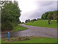
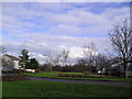
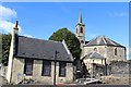
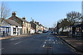
Photos of KA11 4ED


Area Information
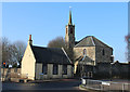
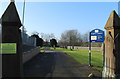
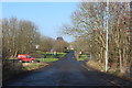
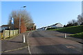
KA11 4ED is a small residential postcode area in Scotland, characterised by its compact size and proximity to key transport links. The area is served by multiple railway stations, including Irvine, Barassie, and Kilmaurs, offering regular connections to larger towns and cities. A ferry terminal at Troon provides access to coastal routes, enhancing mobility for residents. The area’s broadband score of 100 indicates excellent digital connectivity, ideal for remote work or online learning. While mobile coverage scores 82, which is good but not flawless, residents can generally rely on reliable service for daily communication. The area’s small footprint means it is likely a close-knit community, with amenities such as Co-op Dreghorn and Spar within walking distance. This makes KA11 4ED appealing for those seeking a quiet, well-connected residential environment without the pressures of larger urban centres. The absence of flood risk or protected natural sites suggests a low environmental threat profile, which could be a draw for families or retirees. The area’s character is defined by its practicality, blending rural tranquillity with accessible infrastructure.
- Area Type
- Postcode
- Area Size
- Not available
- Population
- Not available
- Population Density
- Not available
House Prices in KA11 4ED
No properties found in this postcode.
Energy Efficiency in KA11 4ED
Living in KA11 4ED offers access to a range of local amenities within practical reach. Retail options include Co-op Dreghorn, Farmfoods Fullarton, and Spar, providing everyday shopping needs. The presence of multiple railway stations, such as Irvine and Kilmaurs, ensures easy access to public transport, while the Troon Ferry Terminal connects residents to coastal routes. Though the data does not specify parks or leisure facilities, the absence of protected natural sites suggests open spaces may be available for recreation. The area’s compact size means residents can walk or cycle to key services, fostering a sense of convenience. The mix of retail, transport, and coastal access creates a lifestyle that balances practicality with accessibility, ideal for those prioritising ease of movement and local convenience.
Amenities
Schools
| Rank | School | Type | Entry gender | Ages |
|---|
Explore more schools in this area
Go to Schools tabDemographics
Household Size
Accommodation Type
Tenure
Ethnic Group
Religion
Household Composition
Age
Household Deprivation
NS-SEC
Explore more demographic insights in this area
Go to Demographics tabPlanning
Planning Constraints
- Flood RiskPremium
- Ramsar Wetland SitesPremium
- Area of Outstanding Natural BeautyPremium
- Protected Nature ReservePremium
- Protected WoodlandPremium
- Crime & SafetyPremium