Area Overview for KA10 7NA
Photos of KA10 7NA


Area Information
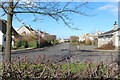
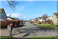
KA10 7NA occupies a distinct residential cluster covering exactly 3,085 square metres. Living in this postcode means you reside within a precisely defined boundary in Scotland rather than a sprawling neighbourhood. The area represents a specific small section of the wider Troon locale. Your daily life is shaped by this compact footprint, which places you in close proximity to essential services and transport links. You are situated just outside the main town centre but retain direct access to the comforts of local retail and dining. This specific postal code serves as your address for legal and administrative matters while you enjoy the benefits of a dedicated residential zone. The small area size indicates a focus on efficiency and proximity, meaning your commute to nearby transport hubs is short. You move through a space where every local amenity is practically within reach without the congestion of a larger urban centre. Your home in KA10 7NA is defined by its location within this tight-knit, well-serviced corner of the region.
- Area Type
- Postcode
- Area Size
- 3085 m²
- Population
- Not available
- Population Density
- Not available
The housing stock in KA10 7NA reflects the broader trends of the West Ayrshire region. Current statistics show that 53.9% of households consist of single people, indicating a high demand for smaller homes or down-sizer properties. The area encompasses a mix of accommodation types, though the data points suggest a significant reliance on the wider district trends rather than a unique housing stock specific to these 3,085 square metres. Approximately 67.7% of the population owner-occupies their home, suggesting a stable investment market rather than a transient rental zone. However, the presence of commercial properties and businesses also features in the wider area data. You are entering a market where the primary need is for efficient living spaces that suit single occupants or small families. Property prices and trends in this postcode will mirror the rest of the Troon and KA10 districts. Buyers looking at homes here should anticipate a market where individual ownership remains the dominant model. The compact nature of the area means each property holds significant value relative to its location within the postcode boundary.
House Prices in KA10 7NA
Showing 4 properties
| Address | Type | Beds | Baths | Last Sale Price | Last Sale Date | |
|---|---|---|---|---|---|---|
| 1 Crossburn Drive, Loans, KA10 7NA | Detached | - | - | - | - | |
| 4 Crossburn Drive, Loans, KA10 7NA | Semi-detached | - | - | - | - | |
| 3 Crossburn Drive, Loans, KA10 7NA | Bungalow | - | - | - | - | |
| 2 Crossburn Drive, Loans, KA10 7NA | Bungalow | - | - | - | - |
Energy Efficiency in KA10 7NA
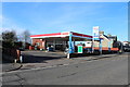
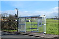
Your lifestyle in KA10 7NA is defined by immediate access to a wide range of practical amenities. You are steps away from five major retail options, including Co-op Troon, Spar Deveron, and a third Spar location. Daily shopping and grocery runs are conducted locally without the need for car travel. Transport links are similarly diverse, with five railway stations serving the community. Barassie Railway Station offers convenient commuter access, while Troon Railway Station serves the town centre hub directly. For long-distance travel, you can reach Prestwick Intl Airport Railway Station easily. If you prefer maritime travel, two ferry terminals are within practical reach, including Troon Ferry Terminal and Ayr Compass Pier. These connections offer seasonal routes to the Isle of Arran and other southern destinations. Two international airports further enhance connectivity, providing Glasgow Prestwick International Airport and Glasgow Prestwick Airport as access points to the rest of the world. You will live in an area where shops, trains, and ferries are all concentrated around your home.
Amenities
Schools
| Rank | School | Type | Entry gender | Ages |
|---|
Explore more schools in this area
Go to Schools tabDemographics
The community profile for KA10 7NA relies entirely on specific national data points for the broader postcode district. Approximately 53.9% of households in the wider KA10 area consist of single occupants. This figure suggests a significant portion of the population lives alone or as couples without children. You will find both owner-occupied homes and rental properties within the immediate vicinity of this postcode. The demographic data indicates a mix of private buyers and tenants seeking accommodation in this specific Scottish location. Deprivation metrics show a low concentration of hardship, with only 1.1% of households facing severe economic challenges compared to the national average. This low level of deprivation points to generally stable living conditions for residents of KA10 7NA. Approximately 12.2% of households include someone over the age of 75, ensuring local services cater to an ageing population within the broader town. Younger families represent 13% of the demographic, though single-person households dominate the picture. You can expect a community where a large number of residents manage their homes independently.
Household Size
Accommodation Type
Tenure
Ethnic Group
Religion
Household Composition
Age
Household Deprivation
NS-SEC
Explore more demographic insights in this area
Go to Demographics tabPlanning
Planning Constraints
- Flood RiskPremium
- Ramsar Wetland SitesPremium
- Area of Outstanding Natural BeautyPremium
- Protected Nature ReservePremium
- Protected WoodlandPremium
- Crime RiskPremium