Area Overview for KA1 4DJ
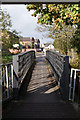
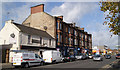
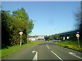
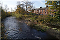
Photos of KA1 4DJ


Area Information
KA1 4DJ is a small residential cluster nestled in the town of Kilmarnock, East Ayrshire, Scotland. This postcode area reflects the historical and industrial legacy of Kilmarnock, a town with roots tracing back to the 14th century and a name derived from the Gaelic “Cill Mhearnaig,” meaning “Church of St. Marnock.” The area is part of a town that grew from a modest burgh of barony in 1592 to a thriving industrial hub by the 19th century, driven by leather, silk, and whisky production. Today, KA1 4DJ retains echoes of this heritage, with landmarks like the Keep of Dean Castle and Loanhead Public School—built in 1905 with a £15,000 investment—adding to its character. Residents here benefit from proximity to Kilmarnock’s rail network, including stations at Kilmarnock, Kilmaurs, and Stewarton, offering connections to larger cities like Glasgow. The area’s compact size means daily life is centred around local amenities, from retail outlets like Iceland Kilmarnock and Lidl Bonnyton to the town’s historic and cultural assets. Living in KA1 4DJ offers a blend of quiet residential living and access to the infrastructure of a town that has long been a cornerstone of Scotland’s economic and social fabric.
- Area Type
- Postcode
- Area Size
- Not available
- Population
- Not available
- Population Density
- Not available
The property market in KA1 4DJ is characterised by a mix of residential types, though specific data on home ownership percentages or property types is not provided. As a small postcode area, the housing stock likely includes a range of homes, from terraced properties to semi-detached or detached dwellings, reflecting Kilmarnock’s historical development as a town with industrial and commercial roots. The area’s proximity to rail stations and retail amenities may make it appealing to buyers seeking a balance between urban convenience and quieter residential living. Given the absence of specific ownership data, it is unclear whether the area is predominantly owner-occupied or rental-focused, but its compact nature suggests a relatively stable market with limited scope for large-scale development.
House Prices in KA1 4DJ
Showing 2 properties
| Address | Type | Beds | Baths | Last Sale Price | Last Sale Date | |
|---|---|---|---|---|---|---|
| Scottishpower, Greenholm Street, Kilmarnock, KA1 4DJ | Office | - | - | - | - | |
| Road And Transportation, Greenholm Street, Kilmarnock, KA1 4DJ | Office | - | - | - | - |
Energy Efficiency in KA1 4DJ
Living in KA1 4DJ offers access to a range of local amenities within practical reach. Retail options include Iceland Kilmarnock, Spar, and Lidl Bonnyton, providing everyday shopping convenience. The nearby rail stations connect residents to Kilmarnock’s town centre and beyond, where historical sites like the Keep of Dean Castle and cultural landmarks such as Loanhead Public School add to the area’s character. While the data does not specify parks or leisure facilities, the proximity to Kilmarnock’s industrial and commercial hubs suggests opportunities for dining, entertainment, and community events. The area’s compact nature means daily life is centred around local services, fostering a sense of convenience and connectivity.
Amenities
Schools
| Rank | School | Type | Entry gender | Ages |
|---|
Explore more schools in this area
Go to Schools tabDemographics
The data does not provide specific demographics for KA1 4DJ, such as age profiles, household types, or diversity statistics. However, Kilmarnock’s historical development as an industrial and commercial centre suggests a community shaped by long-term economic activity, including the whisky industry and manufacturing. The area’s small size and residential focus likely reflect a mix of long-standing residents and those drawn to its connectivity and proximity to services. Without detailed figures, it is challenging to define the community’s composition precisely, but the presence of amenities like rail stations and retail outlets indicates a population that values accessibility and practicality.
Household Size
Accommodation Type
Tenure
Ethnic Group
Religion
Household Composition
Age
Household Deprivation
NS-SEC
Explore more demographic insights in this area
Go to Demographics tabPlanning
Planning Constraints
- Flood RiskPremium
- Ramsar Wetland SitesPremium
- Area of Outstanding Natural BeautyPremium
- Protected Nature ReservePremium
- Protected WoodlandPremium
- Crime RiskPremium