Area Overview for Galston
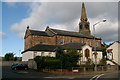
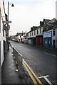
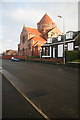
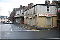
Photos of Galston


Area Information
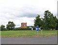
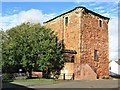
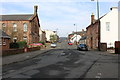
Galston is a compact built-up area in Scotland, covering just 1.3 square kilometres. Its small size means the community feels closely knit, with a straightforward layout that makes it easy to navigate. The area is served by Kilmarnock Railway Station, offering rail links to nearby towns and cities, which is a practical advantage for commuters. Locals have access to essential retail options, including Co-op Galston, Tesco Galston, and Co-op Academy, ensuring daily needs are met without long trips. While Galston’s population figures are not provided, its proximity to amenities and transport suggests a mix of residents, from families to professionals. The area’s character is defined by its practicality and accessibility, making it a viable choice for those seeking a balance between convenience and a sense of community. For buyers, Galston offers a snapshot of Scottish town life, with a focus on local services and connectivity.
- Area Type
- Built Up Area 250
- Area Size
- 1.3 km²
- Population
- Not available
- Population Density
- Not available
Galston offers a range of amenities within easy reach, enhancing the daily lives of its residents. The area is home to Co-op Galston and Tesco Galston, providing essential shopping options for groceries and household items. Co-op Academy adds to the retail mix, offering a variety of services and products. For those who enjoy a more active lifestyle, the nearby rail network connects to Kilmarnock Railway Station, enabling access to cultural, recreational, and professional opportunities beyond the immediate area. While specific details about parks or leisure facilities are not provided, the presence of retail and transport hubs suggests a lifestyle that prioritises convenience and accessibility. The character of Galston is defined by its practical amenities, making it a suitable choice for those who value ease of access to services and connectivity.
Amenities
Schools
| Rank | School | Type | Entry gender | Ages |
|---|
Explore more schools in this area
Go to Schools tabDemographics
Household Size
Accommodation Type
Tenure
Ethnic Group
Religion
Household Composition
Age
Household Deprivation
NS-SEC
Explore more demographic insights in this area
Go to Demographics tabPlanning
Planning Constraints
- Crime RiskPremium