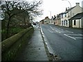
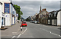
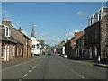
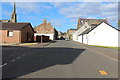
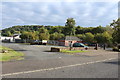
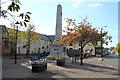
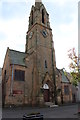
Area Overview for Darvel
Photos of Darvel
Area Information
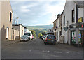
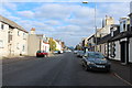
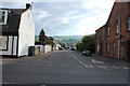
Living in Darvel offers a compact, well-defined urban experience within Scotland’s landscape. Covering 1.1 km², the area is small enough to feel connected yet diverse in its offerings. Residents benefit from proximity to essential retail amenities, including Co-op Darvel, Tesco Galston, and Co-op Galston, which provide daily necessities within easy reach. The area’s digital connectivity is strong, with broadband scores placing it in the excellent category and mobile coverage rated as good. This makes Darvel suitable for those who rely on reliable internet for work or leisure. While specific demographic details are not available, the presence of multiple retail hubs suggests a community that values convenience and accessibility. Darvel’s size and amenities cater to those seeking a balance between urban amenities and the quieter aspects of Scottish living, though its small footprint means it is best suited for those prioritising proximity to services over expansive open spaces.
- Area Type
- Built Up Area 250
- Area Size
- 1.1 km²
- Population
- Not available
- Population Density
- Not available
Residents of Darvel have access to a range of nearby amenities that support daily life. The three notable retail outlets—Co-op Darvel, Tesco Galston, and Co-op Galston—provide essential shopping options, ensuring that groceries, household items, and other necessities are within practical reach. These stores contribute to a convenient, self-contained lifestyle, reducing the need for long journeys to larger centres. While specific details on dining or leisure facilities are not provided, the presence of multiple retail hubs suggests a community that values accessibility and practicality. The area’s small size means that amenities are closely clustered, allowing residents to meet daily needs without significant travel. This compact arrangement fosters a sense of immediacy, where essential services are always nearby, enhancing the overall convenience of living in Darvel.
Amenities
Schools
| Rank | School | Type | Entry gender | Ages |
|---|
Explore more schools in this area
Go to Schools tabDemographics
Household Size
Accommodation Type
Tenure
Ethnic Group
Religion
Household Composition
Age
Household Deprivation
NS-SEC
Explore more demographic insights in this area
Go to Demographics tabPlanning
Planning Constraints
- Crime RiskPremium