Area Overview for Dalry
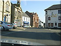
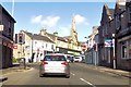
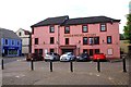
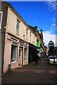
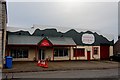
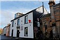
Photos of Dalry


Area Information
Living in Dalry offers a compact yet well-connected experience within Scotland’s built-up areas. Covering 1.8 km², the area is designed for practical living, with essential amenities within reach. Residents benefit from proximity to retail outlets such as Co-op Dalry, Lidl Dalry, and Spar, ensuring daily needs are met without long commutes. The presence of five nearby railway stations, including Dalry and Kilwinning, provides easy access to regional travel, whether for work, leisure, or visiting nearby towns. Digital connectivity is a strong point: broadband scores at 97, indicating excellent fixed-line quality, while mobile coverage at 82 suggests reliable connectivity for most purposes. This makes Dalry a viable option for those working remotely or requiring consistent internet access. The area’s compact size and strategic placement near transport hubs create a balance between urban convenience and the quieter aspects of a smaller community. For buyers, Dalry presents a blend of practicality and accessibility, ideal for those prioritising ease of movement and modern infrastructure.
- Area Type
- Built Up Area 250
- Area Size
- 1.8 km²
- Population
- Not available
- Population Density
- Not available
Daily life in Dalry is shaped by its accessible amenities and community-focused layout. The retail scene includes Co-op Dalry, Lidl Dalry, and Spar, offering a range of groceries and convenience items. These shops support a practical lifestyle, reducing the need for long trips to larger centres. While specific details on dining or leisure options are not provided, the presence of multiple retail outlets suggests a vibrant local economy. The area’s rail connections to nearby stations also open up opportunities for cultural and recreational activities beyond Dalry. The compact size of the area means amenities are within walking or short driving distance, fostering a sense of ease. For residents, this balance of retail access and transport links contributes to a lifestyle that prioritises convenience without sacrificing the benefits of a connected location.
Amenities
Schools
| Rank | School | Type | Entry gender | Ages |
|---|
Explore more schools in this area
Go to Schools tabDemographics
Household Size
Accommodation Type
Tenure
Ethnic Group
Religion
Household Composition
Age
Household Deprivation
NS-SEC
Explore more demographic insights in this area
Go to Demographics tabPlanning
Planning Constraints
- Crime RiskPremium