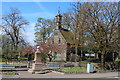
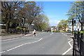
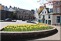
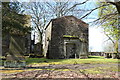
Area Overview for Beith
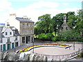
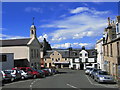
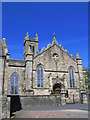
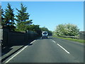
Photos of Beith


Area Information
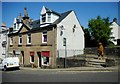
Beith is a built-up area located in Scotland that covers 2.6 square kilometres. Residents experience daily life in a compact settlement designed for practical living. You will find that homes in Beith are situated close to essential services, creating a convenient routine without the need for long commutes to the nearest commercial hubs. This area functions effectively as a local community where many daily needs are met within walking distance or a short drive. The layout supports a straightforward lifestyle, making it an attractive option for those seeking stability and convenience. Living in Beith means enjoying a established residential environment where the scale remains manageable for families and individuals alike. The area's size allows for a sense of familiarity while still providing access to broader regional opportunities through nearby transport links. It is a place where routine dominates, offering reliability for both work and leisure activities. The physical footprint of the town supports a cohesive neighbourhood where residents can navigate their surroundings with ease.
- Area Type
- Built Up Area 250
- Area Size
- 2.6 km²
- Population
- Not available
- Population Density
- Not available
Residents of Beith benefit from practical amenities located within practical reach of the 2.6 square kilometre area. For your daily shopping needs, the Co-op Beith offers essential groceries and household items straight in the town centre. If you require a larger supermarket run, you can access Tesco Kilbirnie and Spar, both of which are listed as notable retail options nearby. Transport connections are robust, with five railway stations identified within easy commuting distance. You can reach Glengarnock Railway Station, Lochwinnoch Railway Station, and Dalry Railway Station for connections to Glasgow and other major hubs. This rail network gives you flexibility to travel for work or leisure without relying solely on road networks. The selection of five retail outlets ensures you have enough variety for weekly provisions without needing to drive far. Local shops complement the larger chain stores, providing the essentials you need on a regular basis. Living in Beith offers a convenient blend of independent and major retailer access alongside efficient rail interchange points.
Amenities
Schools
| Rank | School | Type | Entry gender | Ages |
|---|
Explore more schools in this area
Go to Schools tabDemographics
The specific age profile, household types, home ownership levels, and diversity data are not included in the current information for this area. Consequently, you cannot determine the exact mix of commuters, retirees, or students living in Beith at this time. Similarly, there is no available information regarding the proportion of owner-occupiers versus private renters within the community boundaries. You cannot assess the specific accommodation types, such as the balance between semi-detached, terraced, or flat living arrangements, as these figures are absent. Deprivation statistics and quality of life metrics linked to demographic factors are also not provided in the dataset. Without these specific numbers, any claims about the social composition of Beith would be pure speculation. A prospective buyer cannot rely on reported data to understand the generational mix or the ethnic diversity of the neighbourhood. The lack of published demographic details prevents a clear picture of who currently calls Beith home. You must treat the resident profile as unknown rather than attempting to infer characteristics based on incomplete records.
Household Size
Accommodation Type
Tenure
Ethnic Group
Religion
Household Composition
Age
Household Deprivation
NS-SEC
Explore more demographic insights in this area
Go to Demographics tabPlanning
Planning Constraints
- Crime & SafetyPremium