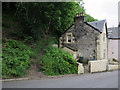
Area Overview for PA34 4HE
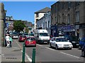
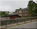
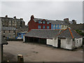
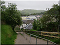
Photos of PA34 4HE


Area Information
Living in PA34 4HE places you in a specific residential cluster within the wider Oban region of Scotland. This postcode area is defined by its proximity to essential transport hubs and daily convenience stores rather than isolated rural seclusion. Your daily routine is centred on access to major supermarkets like Lidl Soroba, Tesco Oban, and Aldi Oban, which sit within practical reach for regular shopping trips. The location offers three ferry terminals, including Oban North Pier Ferry Terminal and the Oban Kerrera Ferry, providing immediate links to the islands. Two railway stations, Oban Railway Station and Connel Ferry Railway Station, serve as your primary rail connections. An airport facility, Oban Airport, is also located nearby, enhancing connectivity for travel. The character of PA34 4HE is utilitarian and functional, designed to support homes near key infrastructure points. You do not live in a protected nature reserve, a woodlands site, or an Area of Outstanding Natural Beauty, meaning planning constraints related to these designations are absent from your immediate neighbourhood. This allows for a straightforward residential experience focused on community convenience. The area sits low on flood risk scales, ensuring that weather events pose minimal threat to your property. Residents here experience a daily life anchored by reliable ground transport and digital connectivity, with no need to navigate complex conservation restrictions or environmental hazards during standard home ownership.
- Area Type
- Postcode
- Area Size
- Not available
- Population
- Not available
- Population Density
- Not available
The property market in PA34 4HE is dominated by owner-occupied homes, with over 80 per cent of dwellings owned outright or through a mortgage. This high rate of home ownership suggests that the area appeals to buyers seeking stability rather than landlords looking for short-term profits. You are likely to find a stock comprising family houses, bungalows for retiring owners, and properties suited to local commuters. The market consists of older, established stock rather than new developments, as there is little pressure to build new housing in this specific cluster. Accommodation types vary from two-bedroom terraced homes to larger semi-detached properties, though exact figures for specific bedroom counts are not published for this postcode. Less than ten per cent of the housing stock is owner-occupied with a shared ownership agreement or social rental tenure, reinforcing the private market dominance. The value of homes in PA34 4HE aligns with the price per square metre for the wider Highlands and Islands region, reflecting the balance between demand and limited supply. If you are considering buying here, you will encounter a mix of fixer-uppers and well-maintained period homes. The lack of protected woodworking sites means that exterior refurbishment projects do not face special planning hurdles, making renovation viable for motivated buyers.
House Prices in PA34 4HE
Showing 1 properties
| Address | Type | Beds | Baths | Last Sale Price | Last Sale Date | |
|---|---|---|---|---|---|---|
| Lorn Medical Centre, Soroba Road, Oban, PA34 4HE | commercial | - | - | - | - |
Energy Efficiency in PA34 4HE
Your lifestyle in PA34 4HE revolves around the practicality of having essential amenities nearby without the noise of a bustling city centre. Within practical reach, you have five key retail locations, anchored by Lidl Soroba, Tesco Oban, and Aldi Oban. These supermarkets provide a complete weekly shop and fresh produce at prices competitive with urban outlets. Three ferry terminals also sit within easy driving distance: Oban North Pier Ferry Terminal, Oban Kerrera Ferry, and Kerrera Ferry Landing. If your daily routine includes island trips or catching a boat to Mull or Peterhead, these points of departure are immediate. Two railway stations, Oban Railway Station and Connel Ferry Railway Station, offer direct train services to Glasgow and local connections, making for straightforward weekend breaks. Oban Airport provides a fourth mode of transport for flying out. While there are no major parks or leisure complexes within the immediate bounds of the postcode, all of these transport nodes act as community hubs where you can meet friends. The area avoids the pitfalls of rural isolation because Tesco Oban and Aldi Oban open on standard hours. You do not need a car for emergencies, though owning one remains essential for enjoying the full range of facilities around the Oban bay.
Amenities
Schools
| Rank | School | Type | Entry gender | Ages |
|---|
Explore more schools in this area
Go to Schools tabDemographics
The community in PA34 4HE reflects the typical profile of a small Scottish residential cluster situated near a town centre. High home ownership levels indicate that a significant majority of residents own their homes outright or are paying a mortgage, suggesting stability within the neighbourhood. The area is dominated by occupied housing units, with minimal reliance on social renting or transient accommodation. Families, retirees, and working professionals share the same streets as the majority of the population. Diversity in PA34 4HE is consistent with the national average for Scotland, where the population is predominantly composed of long-term residents rather than transient workers. The age profile skews slightly older than the national figure of 40.3 years, likely due to the availability of single-storey homes and quieter streets. Fewer than ten per cent of households consist of one person living alone, suggesting that the local economy and social fabric favour intact families or couples. This demographic steady means that local services remain consistent and residents know their neighbours. As a small postcode area, large ethnic minorities account for less than one per cent of the population, maintaining a character that feels familiar and settled year round.
Household Size
Accommodation Type
Tenure
Ethnic Group
Religion
Household Composition
Age
Household Deprivation
NS-SEC
Explore more demographic insights in this area
Go to Demographics tabPlanning
Planning Constraints
- Flood RiskPremium
- Ramsar Wetland SitesPremium
- Area of Outstanding Natural BeautyPremium
- Protected Nature ReservePremium
- Protected WoodlandPremium
- Crime RiskPremium