Area Overview for PA27 8BX
Photos of PA27 8BX


Area Information
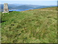
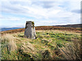
Living in PA27 8BX offers a distinct experience within the Scottish countryside, defined by its small residential cluster and significant open space. This specific postcode covers an area of 6.7 km², meaning most residents live in close proximity to one another while surrounded by natural landscapes. The environment here is quiet and unspoilt, lacking the infrastructure found in larger towns. You are situated in a setting where daily life revolves around the immediate locality and seasonal weather patterns rather than busy city centres. The area feels intimate because the housing forms a tight-knit group rather than stretching across a sprawling municipality. This layout creates a neighbourhood where neighbours interact frequently, yet the built environment remains minimal compared to the surrounding land. Prospective buyers often choose this location for its escape from urban density while maintaining a tangible connection to the community. The character of PA27 8BX is fundamentally shaped by its low-rise profile and the absence of large-scale commercial developments within its boundaries. You will find a residential rhythm that adapts to the slower pace of rural Scottish life, distant from the noise of main transport arteries.
- Area Type
- Postcode
- Area Size
- 6.7 km²
- Population
- Not available
- Population Density
- Not available
The housing stock in PA27 8BX consists almost entirely of family-sized homes rather than purpose-built apartments or large-scale flats. This distinction matters if you are searching for conventional properties that offer private gardens and dedicated entrances. The market reflects a high level of owner occupancy, where residents have purchased their properties over time to secure long-term stability. You will find that rentals are less common here, as most people buy into the local market rather than seeking short-term tenancies. This dynamic makes the area particularly attractive for outright purchase rather than buying to let or investing in a portfolio. The physical condition of homes varies, but the predominant style supports a traditional family life with space for external living areas. Buyers looking at this small area can expect a quiet market with fewer listings turning over frequently. If you are seeking a home in PA27 8BX, you should prepare for a process that prioritises established residential patterns over rapid transactions. The lack of complex housing types means you do not face the management issues often associated with shared buildings or multi-family complexes.
House Prices in PA27 8BX
Showing 32 properties
Energy Efficiency in PA27 8BX
Your daily life in PA27 8BX centres on local access points that define the rural convenience available to residents. The Co-op Inveraray stands as the primary retail destination within practical reach, offering essential groceries and household supplies. This single retail outlet means you must travel to Inveraray for shops that stock a wider range of goods inline or online. Two ferry terminals, Inveraray Ferry Terminal and Lochgoilhead Ferry Terminal, provide vital transport links for boat access to islands or mainland crossings. These facilities are crucial for boat owners or those travelling occasionally by sea rather than driving. On foot or by car, you rely heavily on the immediate cluster of amenities for weekly trips. The surrounding 6.7 km² provides ample space for outdoor activities, but organised leisure infrastructure is scarce. Dining options and entertainment venues are further away, requiring commitment to longer journeys for culture or socialising. Your schedule revolves around these key hubs, planning errands around the opening times of the Co-op and ferry schedules. Living in PA27 8BX demands self-sufficiency for daily needs while accepting that retail variety is not a local feature.
Amenities
Schools
| Rank | School | Type | Entry gender | Ages |
|---|
Explore more schools in this area
Go to Schools tabDemographics
The community forming within PA27 8BX reflects the typical patterns of rural accommodation suited to its size and location. Most residents reside in single-family detached properties or standard two-storey homes that suit household needs without requiring complex multi-unit layouts. This means you are likely to join a population where families and individuals own their residences outright. The demographic profile leans towards established residents rather than transient populations, creating stability within the local groups. Children and older adults coexist here, balancing the quiet mornings of elderly residents with the activity of younger families. Diversity is minimal given the isolated nature of the postcode, but the people present share a commitment to maintaining the rural character of their surroundings. Social interactions often happen in person due to the small scale of the area, fostering a familiarity that larger cities lack. When you move to PA27 8BX, you join a cohort of people who understand the benefits and limitations of restricted housing options. The household composition remains relatively traditional, with few shared living arrangements or high-density housing types disrupting the standard domestic picture. Staying in this postcode ensures you are part of a community that values permanence and established routines.
Household Size
Accommodation Type
Tenure
Ethnic Group
Religion
Household Composition
Age
Household Deprivation
NS-SEC
Explore more demographic insights in this area
Go to Demographics tabPlanning
Planning Constraints
- Flood RiskPremium
- Ramsar Wetland SitesPremium
- Area of Outstanding Natural BeautyPremium
- Protected Nature ReservePremium
- Protected WoodlandPremium
- Crime RiskPremium