Area Overview for Kirriemuir
Photos of Kirriemuir
Area Information
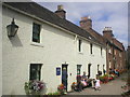
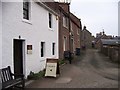
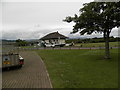
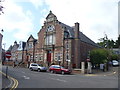
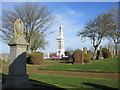
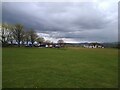
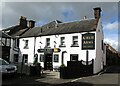
Kirriemuir sits as a distinctive burgh in Angus, Scotland, occupying a compact total area of 2.3 km². This built-up neighbourhood lies on the north side of the Strathmore valley, positioned roughly six miles west-north-west of Forfar and about twenty miles north-west of Dundee. History defines its character more than modern statistics do. The town traces its roots back to a mention in 1201, received a charter in 1459, and specialised in textile production from the 1760s. Richard Dallas and later generations of its inhabitants shaped a legacy visible today through local attractions. You might find yourself visiting the National Trust for Scotland birthplace museum of J.M. Barrie on Brechin Road, where the author of Peter Pan was born. The red sandstone buildings provide a visual link to the past, supporting the local nickname of a wee red toonie. Daily life here blends rural tranquillity with historic charm. You are walking distance from the Old Parish Church, a 13th-century focal point, and can follow a town heritage trail shaped by Bronze Age settlements and Roman passage stones. Living in Kirriemuir means engaging with a community that values its deep historical connections while functioning as a practical service centre for the surrounding countryside.
- Area Type
- Built Up Area 250
- Area Size
- 2.3 km²
- Population
- Not available
- Population Density
- Not available
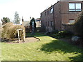
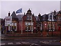
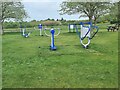
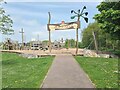
Living in Kirriemuir offers access to practical retail and leisure facilities within a historic rural setting. The immediate vicinity contains five notable retail venues, providing essential shopping without the need to travel to Forfar. Supermarkets such as the Co-op Kirriemuir, Spar, and Aldi Forfar are within practical reach, meeting your everyday grocery needs. For cultural engagement, you have direct access to the J.M. Barrie Birthplace Museum on Brechin Road, which houses a statue of Peter Pan in the square. The Kirriemuir Heritage Centre, known as the Gateway to the Glens Museum, covers town history on site. Outdoor pursuits are supported by the Old Parish Church grounds and the town heritage trail. Nearby Forter Castle, built in 1560 and restored, adds historical depth to local outings. The area serves as a hub for visitors interested in Pictish stones and Bronze Age evidence found in the landscape. Dining options are tied to local gingerbread producers originating around 1900. Your daily routine blends convenience with the ability to explore significant Scottish heritage. The combination of local shops and museums creates a self-contained lifestyle for enthusiasts of history and history-based tourism.
Amenities
Schools
| Rank | School | Type | Entry gender | Ages |
|---|
Explore more schools in this area
Go to Schools tabDemographics
The provided research material does not include specific figures regarding age profiles, household types, home ownership levels, or ethnic diversity for residents of Kirriemuir. Consequently, a detailed statistical breakdown of the community cannot be constructed from the available information. Without exact numbers on population density, average age, or the proportion of owner-occupiers versus private landlords, it is impossible to describe the housing stock composition or deprivation levels with precision. The available text focuses on historical events, such as the peak of 1,500 handloom weavers by 1860, and geographical characteristics rather than modern census data. You should be aware that a thorough understanding of the current demographic make-up requires external sources not present in this dataset. Specific statistics on accommodation types and local working-age populations are absent. Therefore, any attempt to list age distributions or income brackets would be purely speculative and must be avoided. The narrative regarding who lives here remains focused on the town's heritage and its role as a tourist attraction linked to local history, rather than on modern social stratification metrics.
Household Size
Accommodation Type
Tenure
Ethnic Group
Religion
Household Composition
Age
Household Deprivation
NS-SEC
Explore more demographic insights in this area
Go to Demographics tabPlanning
Planning Constraints
- Crime RiskPremium