Area Overview for DD9 7UQ
Photos of DD9 7UQ


Area Information
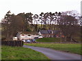
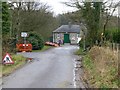
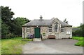
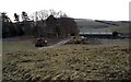
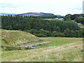
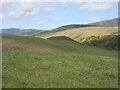
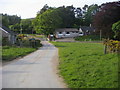
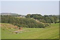
Living in DD9 7UQ means residing within a specific residential cluster spanning 1.3 square kilometres in the Angus council area of Scotland. This location sits on the east coast of Scotland, north-east of Dundee, and is bounded by the North Sea and the Firth of Tay. The wider region serves as the historic heartland of the Picts and is famously known as the birthplace of Scotland due to the signing of the Declaration of Arbroath in 1320. Residents here are part of a landscape that transitions from expansive mountains and valleys in the north to prime agricultural land and a historic coastline in the east. Daily life for those choosing homes in this postcode area is shaped by its position within Angus, one of Scotland's 32 local government council areas. The region includes major towns such as Forfar, Arbroath, Brechin, and Montrose, providing a balance between rural setting and access to broader amenities. While DD9 7UQ itself is a small residential cluster, it benefits from the proximity to significant historical sites like Arbroath Abbey and the Bell Rock Lighthouse, which stands as one of the Seven Wonders of the Industrial World. As you consider settling down in this part of Angus, you are entering an area with deep historical roots and a varied natural environment, ranging from the high point of Glas Maol to the North Sea shore.
- Area Type
- Postcode
- Area Size
- 1.3 km²
- Population
- Not available
- Population Density
- Not available
The current property market data for DD9 7UQ does not include home ownership percentages or specific details on the housing stock. You cannot determine whether this small residential cluster is predominantly owner-occupied or used largely for private rental purposes based on the available information. Similarly, there is no data outlining the types of homes that predominate in this 1.3 square kilometre area. Because specific property type data is absent, it is difficult to paint a picture of the local housing inventory for buyers. You cannot confirm if there are detached houses, shared flats, or other specific structures within DD9 7UQ without further research sources. This limits the ability to tell prospective buyers whether the area fits their preferred lifestyle regarding property ownership.
House Prices in DD9 7UQ
Showing 8 properties
Energy Efficiency in DD9 7UQ
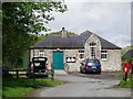
Residents of DD9 7UQ can access one main retail amenity within practical reach: a Spar convenience store. This single retail option provides essential daily necessities, but it does not offer the variety found in larger towns like Forfar or Arbroath. The lifestyle convenience in this specific cluster is therefore limited, requiring residents to travel to nearby larger centres for anything beyond basic groceries or quick convenience items. Beyond immediate retail, the quality of life is heavily influenced by the surrounding environment. The postcode falls within close proximity to the Angus council area, which boasts a varied landscape ranging from mountains to the North Sea coastline. You are situated in a region famous for historical sites, including the Arbroath Signal Tower museum and the J M Barrie Museum in Kirriemuir. While the area lacks a density of local shops, the natural and historical assets of Angus provide ample opportunities for leisure and exploration if you are willing to make the journey to towns like Montrose or Arbroath.
Amenities
Schools
| Rank | School | Type | Entry gender | Ages |
|---|
Explore more schools in this area
Go to Schools tabDemographics
The specific population, age profile, and household types for DD9 7UQ are not detailed in the current records. Consequently, a precise breakdown of the community's diversity or exact home ownership levels for this single postcode cannot be stated. However, the wider context of Angus provides a backdrop for understanding the local character. The region includes significant towns like Forfar, which serves as the historic county town and administrative centre. Without specific data on accommodation types for this small cluster, you cannot determine if it is primarily owner-occupied or rental-heavy based on available figures. Deprivation statistics, which often correlate with quality of life and service access, are also not included in the immediate dataset for this location. When researching schools near DD9 7UQ, you must look beyond the postcode itself, as specific school data is not provided for this area. The absence of recorded demographic details means you cannot assess the generational mix or socioeconomic background of the current residents with certainty.
Household Size
Accommodation Type
Tenure
Ethnic Group
Religion
Household Composition
Age
Household Deprivation
NS-SEC
Explore more demographic insights in this area
Go to Demographics tabPlanning
Planning Constraints
- Flood RiskPremium
- Ramsar Wetland SitesPremium
- Area of Outstanding Natural BeautyPremium
- Protected Nature ReservePremium
- Protected WoodlandPremium
- Crime RiskPremium