Area Overview for DD9 7RU
Photos of DD9 7RU
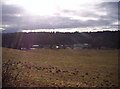
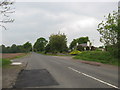
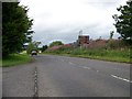
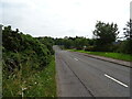
8 photos from this area
Area Information
Key information about the DD9 7RU including its size, population, and administrative classification.
- Area Type
- Postcode
- Area Size
- 7.2 hectares
- Population
- Not available
- Population Density
- Not available
House Prices in DD9 7RU
19
Properties
-
Average Sold Price
-
Lowest Price
-
Highest Price
Showing 19 properties
| Address | Type | Beds | Baths | Last Sale Price | Last Sale Date | |
|---|---|---|---|---|---|---|
| Ron Mackie Cars Ltd, Unit 13, Brechin Industrial Estate, Brechin, DD9 7RU | office_workshop | - | - | - | - | |
| Simpson Joinery, Unit 10, Brechin Industrial Estate, Brechin, DD9 7RU | office_workshop | - | - | - | - | |
| Ls Light And Sound Ltd, Unit 15, Brechin Industrial Estate, Brechin, DD9 7RU | Office | - | - | - | - | |
| Edzell Graphics, Unit 11, Brechin Industrial Estate, Brechin, DD9 7RU | office_workshop | - | - | - | - | |
| Revolution Store Fitting, Unit 6, Brechin Industrial Estate, Brechin, DD9 7RU | office_workshop | - | - | - | - | |
| Lux Traffic Controls, Unit 9, Brechin Industrial Estate, Brechin, DD9 7RU | office_workshop | - | - | - | - | |
| Oilfield Corrosion Monitoring Services Ltd, Unit 8, Brechin Industrial Estate, Brechin, DD9 7RU | storage_distribution | - | - | - | - | |
| Jamieson Removals, Unit 16, Brechin Industrial Estate, Brechin, DD9 7RU | Office | - | - | - | - | |
| 2D Precision Ltd, Units 2/3, Brechin Industrial Estate, Brechin, DD9 7RU | office_workshop | - | - | - | - | |
| James Davidson & Sons, Unit 20, Brechin Industrial Estate, Brechin, DD9 7RU | Industrial | - | - | - | - |
Page 1 of 2
Energy Efficiency in DD9 7RU
Amenities
Schools
| Rank | School | Type | Entry gender | Ages |
|---|
Explore more schools in this area
Go to Schools tabDemographics
Household Size
N/A
most common
Accommodation Type
N/A
most common
Tenure
N/A
majority
Ethnic Group
N/A
most common
Religion
N/A
most common
Household Composition
N/A
most common
Age
N/A
median
N/A
most common
Household Deprivation
N/A
with no deprivation
NS-SEC
N/A
in Lower managerial occupations
Explore more demographic insights in this area
Go to Demographics tabPlanning
Planning Constraints
- Flood RiskPremium
- Ramsar Wetland SitesPremium
- Area of Outstanding Natural BeautyPremium
- Protected Nature ReservePremium
- Protected WoodlandPremium
- Crime RiskPremium