Area Overview for DD9 7AY
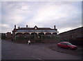
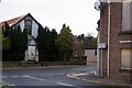
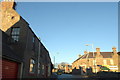
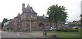
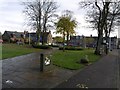
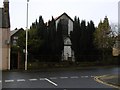
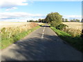
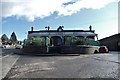
Photos of DD9 7AY


Area Information
DD9 7AY represents a specific residential cluster situated within the expansive council area of Angus in Scotland. This postcode covers a compact area measuring 8363 square metres, offering a focused homebuying option for those seeking a defined local community. Located on Scotland's east coast, the region surrounding this property benefits from a varied landscape that ranges from the historic North Sea coastline to inland agricultural land. The area sits within one of the ancient provinces of Scotland, which was once documented as far back as 937. Residents here enjoy proximity to towns such as Brechin and Bridge of Dun, which serve as key local hubs for daily necessities. While the immediate postcode is small, it connects to a wider region that includes the historic county town of Forfar and major attractions like Glamis Castle and Arbroath Abbey. Living in DD9 7AY means being part of a settlement that balances rural characteristics with access to broader services. The neighbourhood has no significant planning constraints such as protected woodlands or nature reserves, providing flexibility for potential home improvements. This specific location avoids flood risks and Ramsar wetland sites, ensuring a stable environment for building and living. The cluster is part of the broader Angus economy, which relies heavily on agriculture, fishing, and the nearby North Sea oil industry.
- Area Type
- Postcode
- Area Size
- 8363 m²
- Population
- Not available
- Population Density
- Not available
Detailed statistics regarding home ownership percentages and specific accommodation types are not provided for DD9 7AY. Without these specific figures, it is impossible to determine whether this cluster is predominantly owner-occupied or part of the rental market. However, the physical description of the area clarifies that it is a specific postcode covering a small residential cluster. The location offers a distinct advantage in terms of planning constraints, as there is no protected woodland, AONB coverage, or Ramsar wetland sites affecting the housing stock. This lack of restrictions means residents face fewer limitations on property modifications compared to areas within protected zones. The immediate surroundings connect to nearby towns like Brechin and Bridge of Dun, which likely host the broader range of housing types that support the local commerce. Given the total area size of 8363 square metres, the housing mix is likely compact and potentially replaces older stock with modern developments, though specific construction dates or architectural styles are unknown. Buyers looking at this postcode should prepare for a market driven by physical location rather than demographic trends. The area's position within Angus places it near major centres like Arbroath and Forfar, which influence vacancies and rental yields in the wider region, even if local data is absent.
House Prices in DD9 7AY
Showing 2 properties
| Address | Type | Beds | Baths | Last Sale Price | Last Sale Date | |
|---|---|---|---|---|---|---|
| Brechin Health Centre, Infirmary Street, Brechin, DD9 7AY | commercial | - | - | - | - | |
| Brechin Medical Practice, Brechin Health Centre, Infirmary Street, Brechin, DD9 7AY | commercial | - | - | - | - |
Energy Efficiency in DD9 7AY
Residents of DD9 7AY have practical access to essential amenities within a short travel radius. The nearest metro points include Brechin and Bridge of Dun, providing transport links to wider areas. For daily shopping needs, the area offers five retail outlets in close proximity. Key stores include Farmfoods Brechin, Lidl Brechin, and Tesco Brechin, ensuring that groceries and household essentials are easily obtainable without a long commute. This retail density is unusual for a postcode of only 8363 square metres, indicating that the cluster benefits from shared commercial infrastructure in the surrounding towns. The landscape around this residential zone reflects the varied nature of Angus, ranging from expansive mountains and glens to prime agricultural land and a historic North Sea coastline. While specific parks or leisure centre names are not listed for this exact postcode, the region is home to notable attractions such as Glamis Castle, Arbroath Abbey, and the Bell Rock Lighthouse. The economy of the broader region supports leisure through tourism along the coast and in the uplands. This lifestyle is defined by access to rural landscapes and established commercial hubs rather than self-contained local entertainment. Buyers can expect a life centred on driving to nearby towns for services while enjoying the peace of the Angus countryside.
Amenities
Schools
| Rank | School | Type | Entry gender | Ages |
|---|
Explore more schools in this area
Go to Schools tabDemographics
No specific demographic data regarding age profiles, household types, or diversity is currently available for DD9 7AY. Because this postcode covers only 8363 square metres, detailed statistical breakdowns for such a small population are not standard. However, the lack of available figures does not define the quality of life here. Instead, the area operates within the context of Angus, where main towns include Forfar, Arbroath, Brechin, Carnoustie, and Montrose. The region benefits from a mixed economy involving agriculture, fishing, and significant employment in the pharmaceutical sector through GSK in Montrose. Without specific data on employment rates or income levels within the immediate postcode, the community character remains a matter of local observation rather than aggregate statistics. The absence of deprivation data for this specific cluster means you cannot quantify its standing relative to other areas using standard indices. Potential buyers must rely on the general safety and amenity data provided to assess suitability. The area passes all safety assessments for flood risk and planning constraints, suggesting a stable environment regardless of the unknown demographic mix. The community likely reflects the broader rural and semi-rural character of Angus, where families and workers from nearby industrial and agricultural sectors reside.
Household Size
Accommodation Type
Tenure
Ethnic Group
Religion
Household Composition
Age
Household Deprivation
NS-SEC
Explore more demographic insights in this area
Go to Demographics tabPlanning
Planning Constraints
- Flood RiskPremium
- Ramsar Wetland SitesPremium
- Area of Outstanding Natural BeautyPremium
- Protected Nature ReservePremium
- Protected WoodlandPremium
- Crime RiskPremium