Area Overview for DD8 4YF
Photos of DD8 4YF


Area Information
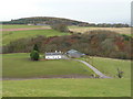
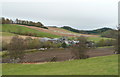
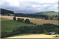
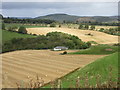
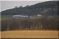
DD8 4YF is a small residential cluster nestled in the Angus council area of Scotland, a region defined by its varied landscape of mountains, valleys, and coastal plains. Covering 36.5 hectares, the area is part of a broader region that stretches from the North Sea coastline to the rolling hills of the east. Residents here benefit from proximity to historic sites like Arbroath Abbey, where the Declaration of Arbroath was signed, and modern amenities such as the Co-op Kirriemuir and Spar in nearby towns. The area’s compact size means it is likely surrounded by open countryside or small villages, offering a quiet, rural lifestyle. Given its location in Angus, which borders the Firth of Tay and the North Sea, the area is within reach of both coastal and inland attractions. For those seeking a balance between tranquillity and accessibility, DD8 4YF provides a base for exploring the region’s agricultural heartland, historic landmarks, and coastal towns like Montrose. The small scale of the area suggests a close-knit community, though specific details about local culture or demographics remain unexplored in the data.
- Area Type
- Postcode
- Area Size
- 36.5 hectares
- Population
- Not available
- Population Density
- Not available
House Prices in DD8 4YF
No properties found in this postcode.
Energy Efficiency in DD8 4YF
Residents of DD8 4YF have access to basic retail amenities within practical reach, including the Co-op Kirriemuir and Spar, which serve as essential stops for groceries and daily essentials. While the data does not specify dining options or leisure facilities, the area’s location in Angus—home to historic sites like Glamis Castle and natural attractions such as the Bell Rock Lighthouse—suggests opportunities for cultural and outdoor activities nearby. The nearby town of Kirriemuir, for instance, hosts the J M Barrie Museum, adding to the region’s appeal for history enthusiasts. The compact nature of the area likely means that parks, walking trails, or open spaces are within short distances, though exact details are not provided. For those prioritising convenience, the presence of local shops and the proximity to larger towns may offer a blend of rural simplicity and accessible amenities.
Amenities
Schools
| Rank | School | Type | Entry gender | Ages |
|---|
Explore more schools in this area
Go to Schools tabDemographics
Household Size
Accommodation Type
Tenure
Ethnic Group
Religion
Household Composition
Age
Household Deprivation
NS-SEC
Explore more demographic insights in this area
Go to Demographics tabPlanning
Planning Constraints
- Flood RiskPremium
- Ramsar Wetland SitesPremium
- Area of Outstanding Natural BeautyPremium
- Protected Nature ReservePremium
- Protected WoodlandPremium
- Crime RiskPremium