Area Overview for DD8 3QY
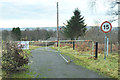
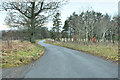
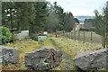
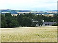
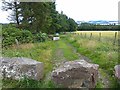
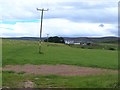
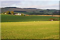
Noranside Prison in DD8 3QY
Approach to Noranside in DD8 3QY
Cattle near Noranside in DD8 3QY
Felled woodland, Drumcuthlaw in DD8 3QY
Closed entrance road to Noranside Prison in DD8 3QY
Minor road near Noranside Prison in DD8 3QY
Blocked entrance to Noranside Prison in DD8 3QY
Noranside Open Prison in DD8 3QY
Blocked gateway to Noranside Prison in DD8 3QY
Fields near Balquhadly Farm in DD8 3QY
Balquhadly Farm, Fern, Angus in DD8 3QY
11 photos from this area

Area Information

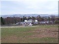
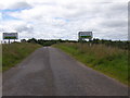
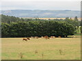
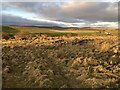
DD8 3QY lies within Angus, a historic council area in Scotland’s east coast, known for its dramatic landscapes and rich heritage. This small postcode cluster sits within a region bounded by the North Sea and the Firth of Tay, offering a mix of coastal charm and rural tranquility. The area is part of a larger region characterised by mountains, valleys, and fertile farmland, with Forfar serving as the administrative heart of Angus. Historically, the area is steeped in significance, including the signing of the Declaration of Arbroath in 1320 at Arbroath Abbey, which earned Angus the title of Scotland’s “birthplace.” Modern-day DD8 3QY benefits from proximity to towns like Forfar and Montrose, which provide access to services, cultural attractions, and employment opportunities. The area’s small residential cluster suggests a close-knit community, with homes likely situated near natural features such as the North Sea coastline or the upland glens. Daily life here may blend rural simplicity with historical intrigue, offering a quiet alternative to larger urban centres.

Area Type
Postcode
Area Size
Not available
Population
Not available
Population Density
Not available

House Prices in DD8 3QY

No properties found in this postcode.

Energy Efficiency in DD8 3QY

Amenities

Schools

RankA + A* %SchoolTypeEntry genderAges

Explore more schools in this area

Go to Schools tab

Demographics

Household Size

N/A
most common

Accommodation Type

N/A
most common

Tenure

N/A
majority

Ethnic Group

N/A
most common

Religion

N/A
most common

Household Composition

N/A
most common

Age

N/A
median
N/A
most common

Household Deprivation

N/A
with no deprivation

NS-SEC

N/A
in Lower managerial occupations

Explore more demographic insights in this area

Go to Demographics tab

Planning

Planning Constraints

  • Flood Risk
    Locked
  • Ramsar Wetland Sites
    Locked
  • Area of Outstanding Natural Beauty
    Locked
  • Protected Nature Reserve
    Locked
  • Protected Woodland
    Locked
  • Crime Risk
    Locked

Explore more planning insights in this area

Open Planning map

Frequently Asked Questions

What is the community like in DD8 3QY?
DD8 3QY is a small residential cluster within Angus, a historic region in Scotland. The area is part of a council area with a varied landscape, including coastal and upland features. Proximity to towns like Forfar and Montrose suggests access to local amenities, though the small size of the postcode implies a close-knit community. The region’s historical significance, such as the Declaration of Arbroath, adds cultural depth to the area.
Who typically lives in DD8 3QY?
Residents of DD8 3QY are likely to be part of a small, rural community with ties to Angus’s agricultural and coastal industries. The area’s proximity to towns like Montrose and Forfar may attract those working in local services, tourism, or the North Sea oil sector. The absence of detailed demographic data means specific population profiles are not available.
How reliable is internet and mobile coverage in DD8 3QY?
Mobile coverage in DD8 3QY is rated at 82 out of 100, indicating strong cellular service. Broadband quality, however, is rated at 12 out of 100, suggesting limited fixed-line internet. This may affect remote work or high-bandwidth needs, though mobile networks offer a practical alternative for communication and navigation.

We use cookies to provide you with the best experience. By continuing, you agree to our Cookie Policy .