Area Overview for DD8 3JA
Photos of DD8 3JA


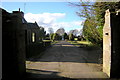
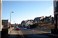
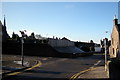
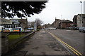
100 photos from this area
Area Information
Key information about the DD8 3JA including its size, population, and administrative classification.
- Area Type
- Postcode
- Area Size
- 4.0 hectares
- Population
- Not available
- Population Density
- Not available
House Prices in DD8 3JA
21
Properties
-
Average Sold Price
-
Lowest Price
-
Highest Price
Showing 21 properties
| Address | Type | Beds | Baths | Last Sale Price | Last Sale Date | |
|---|---|---|---|---|---|---|
| Kwik-fit, Tyre And Exhaust Centre, Queenswell Road, Forfar, DD8 3JA | warehouse | - | - | - | - | |
| Angus Council, Council Depot, Queenswell Road, Forfar, DD8 3JA | warehouse | - | - | - | - | |
| Lidl, Supermarket, Queenswell Road, Forfar, DD8 3JA | office_workshop | - | - | - | - | |
| Queenswell Coachworks, Workshop And Store, Queenswell Road, Forfar, DD8 3JA | office_workshop | - | - | - | - | |
| En Robertson & Son, Workshop, Queenswell Road, Forfar, DD8 3JA | Industrial | - | - | - | - | |
| Forfar Horticultural Society, Hut, 11 Lochside Road, Forfar, DD8 3JA | Retail | - | - | - | - | |
| Thrums Veterinary Group, Veterinary Surgery, Queenswell Road, Forfar, DD8 3JA | commercial | - | - | - | - | |
| Mcconechy's, Tyre Workshop, Queenswell Road, Forfar, DD8 3JA | office_workshop | - | - | - | - | |
| Carpetright, Showroom, Queenswell Road, Forfar, DD8 3JA | shop | - | - | - | - | |
| Fisken Motor Group, 12 Queenswell Road, Forfar, DD8 3JA | Industrial | - | - | - | - |
Page 1 of 3
Energy Efficiency in DD8 3JA
Amenities
Schools
| Rank | School | Type | Entry gender | Ages |
|---|
Explore more schools in this area
Go to Schools tabDemographics
Household Size
N/A
most common
Accommodation Type
N/A
most common
Tenure
N/A
majority
Ethnic Group
N/A
most common
Religion
N/A
most common
Household Composition
N/A
most common
Age
N/A
median
N/A
most common
Household Deprivation
N/A
with no deprivation
NS-SEC
N/A
in Lower managerial occupations
Explore more demographic insights in this area
Go to Demographics tabPlanning
Planning Constraints
- Flood RiskPremium
- Ramsar Wetland SitesPremium
- Area of Outstanding Natural BeautyPremium
- Protected Nature ReservePremium
- Protected WoodlandPremium
- Crime RiskPremium