Area Overview for DD8 2WG
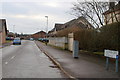
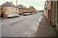
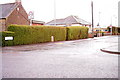
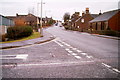
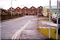
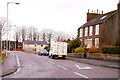
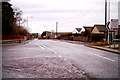
Photos of DD8 2WG

Area Information
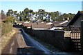
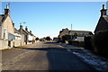
DD8 2WG represents a specific residential cluster located within the broader town of Forfar. This historic market town serves as the county town of Angus and sits on the eastern end of Forfar Loch. The total area size of this specific postcode cluster is 1.1 hectares, indicating a compact living environment rather than sprawling suburban development. Forfar possesses a population of approximately 15,700 residents as of the 2022 census, creating a tight-knit community atmosphere. The town blends its heritage as a former royal burgh with modern administrative functions. Residents enjoy a scenic valley setting that provides a backdrop of natural beauty while maintaining access to regional centres. The location is approximately 13 miles north of Dundee and sits at the start of the A90 corridor connecting to Aberdeen. Living in DD8 2WG means choosing a settlement with deep historical roots, including sites like Restenneth Priory and the Dunnichen Stone nearby. The area functions as a base for exploring the Angus Glens and benefiting from a robust local agricultural industry. You gain access to a community centred around historic market traditions alongside contemporary services.
- Area Type
- Postcode
- Area Size
- 1.1 hectares
- Population
- Not available
- Population Density
- Not available
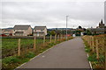
Housing in DD8 2WG exists within the context of Forfar's broader property landscape. The town functions as a mixed market combining historic character with modern residential needs. As a specific postcode covering a small residential cluster of 1.1 hectares, the housing stock is likely dense and varied. Forfar contains properties ranging from historic burgh architecture to newer developments suitable for a growing population of 15,700. The town's economic drivers, including Strathmore Foods and Strathmore Spring Water, attract workers who require accessible housing. While specific home ownership percentages or accommodation type breakdowns for this exact postcode are not detailed, the town status implies a significant owner-occupied element alongside tenanted properties. Buyers looking at homes in DD8 2WG can expect properties near key landmarks such as Town Hall or Restenneth Priory. The market benefits from the town's role as a county town, ensuring steady demand from civil servants and local employees. You may find both period conversions and family homes within this compact area. The proximity to Dundee and Aberdeen via the A90 road adds value to properties in this cluster. The property market here reflects the town's enduring appeal as a historic market town with modern conveniences.
House Prices in DD8 2WG
Showing 5 properties
| Address | Type | Beds | Baths | Last Sale Price | Last Sale Date | |
|---|---|---|---|---|---|---|
| 3 Mossie Park, Gowanbank, Forfar, DD8 2WG | Bungalow | - | - | - | - | |
| 5 Mossie Park, Gowanbank, Forfar, DD8 2WG | house | - | - | - | - | |
| 1 Mossie Park, Gowanbank, Forfar, DD8 2WG | house | - | - | - | - | |
| 2 Mossie Park, Gowanbank, Forfar, DD8 2WG | house | - | - | - | - | |
| 4 Mossie Park, Gowanbank, Forfar, DD8 2WG | Detached | - | - | - | - |
Energy Efficiency in DD8 2WG
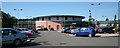
Living in DD8 2WG provides immediate access to a range of retail amenities within practical reach. Five notable retail venues serve the local community, including Spar, Morrisons Daily Forfar, and Tesco Forfar. These shops provide everyday necessities without the need to travel far. Forfar is a historic market town that successfully maintains convenient shopping options alongside its administrative and cultural roles. Residents can walk or take a short drive to meet these providers of fresh food and daily goods. The town's economy is driven by local industries such as Strathmore Foods, which produces 200,000 Scotch pies weekly. This industrial activity brings economic vitality to the region. Nearby amenities include Forfar Museum, where visitors can examine historic witch torture devices and learn about local trials. You can visit St James' Church, the Market Cross, and view ruins at Forfar Castle on Castle Hill. The presence of Reid Hall and the Town Hall adds to the civic atmosphere of the area. Relaxation finds support through proximity to Forfar Loch, located in the Strathmore valley. Dining and leisure options are accessible through the town's established high street. Your daily life in DD8 2WG balances the convenience of modern supermarkets with the charm of historic tourist attractions.
Amenities
Schools
| Rank | School | Type | Entry gender | Ages |
|---|
Explore more schools in this area
Go to Schools tabDemographics
The demographic profile of Forfar reflects its identity as a small burgh town with a stable population. The town recorded a population of about 15,700 people in 2022, a figure that has grown slightly from the 14,050 recorded in 2011. This growth suggests a continuing attraction for residents in the region. The community maintains a consistent character supported by its agricultural heritage and role as the administrative centre of Angus council area. While detailed age breakdowns or household type statistics are not explicitly listed for this specific small postcode, the town's overall size indicates a mix of families and individuals drawn to its historic charm and modern amenities. The population growth from 2011 to 2022 highlights a positive trend in settlement stability. Living in DD8 2WG places you within a community that has weathered significant historical events, from Roman occupation to the textile industry boom. The town supports a working population involved in food processing and agriculture, notably seed potato production and pie manufacturing. You are part of a settlement that balances rural roots with urban infrastructure. The population figures confirm a robust local community presence without the pressures of larger city living.
Household Size
Accommodation Type
Tenure
Ethnic Group
Religion
Household Composition
Age
Household Deprivation
NS-SEC
Explore more demographic insights in this area
Go to Demographics tabPlanning
Planning Constraints
- Flood RiskPremium
- Ramsar Wetland SitesPremium
- Area of Outstanding Natural BeautyPremium
- Protected Nature ReservePremium
- Protected WoodlandPremium
- Crime RiskPremium