Area Overview for DD8 2WB
Photos of DD8 2WB
Area Information
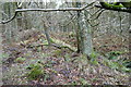
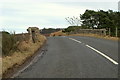
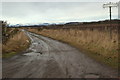
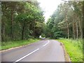
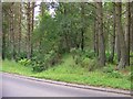
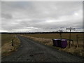
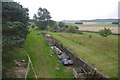
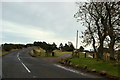
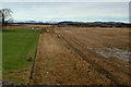
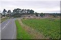
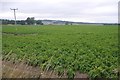
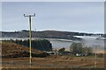
DD8 2WB lies within the Angus council area of Scotland, a region defined by its rugged landscapes and coastal charm. This postcode covers a small residential cluster, nestled in a part of the country known for its historic roots and natural beauty. The area is bordered by the North Sea to the east and the Firth of Tay to the south, offering a mix of coastal vistas and inland scenery. Forfar, the administrative centre of Angus, is a short distance away, providing access to local services and cultural attractions. The region’s history is deeply woven into its identity, from the signing of the Declaration of Arbroath in 1320 to the presence of landmarks like Glamis Castle and the Bell Rock Lighthouse. Daily life in DD8 2WB is shaped by its rural setting, with a quiet, community-focused rhythm. Residents benefit from proximity to towns like Arbroath and Montrose, which offer amenities, while the surrounding countryside provides opportunities for outdoor pursuits. The area’s small size means a tight-knit feel, with a focus on local traditions and natural surroundings.
- Area Type
- Postcode
- Area Size
- Not available
- Population
- Not available
- Population Density
- Not available
The property market in DD8 2WB reflects its status as a small, residential postcode within a rural Scottish setting. The area likely consists of a mix of traditional homes, including semi-detached and detached properties, given the prevalence of such housing types in Angus. Home ownership appears to be a significant factor, as the area’s compact size and proximity to towns like Forfar and Arbroath may attract buyers seeking a quieter, community-oriented lifestyle. However, specific figures on ownership rates or property prices are not available. The limited number of properties in such a small postcode suggests a niche market, potentially with lower turnover. For buyers, this means a focus on local character and proximity to natural landscapes, though the small size of the area may limit options for those seeking larger estates or modern developments.
House Prices in DD8 2WB
No properties found in this postcode.
Energy Efficiency in DD8 2WB
Residents of DD8 2WB have access to a range of nearby amenities within practical reach, including five retail outlets such as Spar Forfar and Spar Ms. These shops provide essentials, reflecting the area’s small-scale, community-focused retail landscape. While larger supermarkets or dining options are not listed, the proximity to towns like Forfar and Arbroath offers more extensive choices. The area’s rural setting means parks and open spaces are likely abundant, though specific names are not provided. The surrounding countryside, with its mix of valleys, glens, and coastal areas, supports outdoor activities like walking or cycling. The character of daily life is shaped by local traditions, historic sites, and a connection to the natural environment, making it appealing to those seeking a slower pace of life.
Amenities
Schools
| Rank | School | Type | Entry gender | Ages |
|---|
Explore more schools in this area
Go to Schools tabDemographics
The data available does not include specific demographic details such as age profiles, household types, or diversity statistics for DD8 2WB. However, Angus as a whole is characterised by a mix of rural and small-town communities, with towns like Forfar and Arbroath serving as cultural and economic hubs. The region’s economy is driven by agriculture, fishing, and tourism, which may influence the local population’s composition. While no figures are provided on home ownership or deprivation levels, the area’s small-scale residential nature suggests a balance between owner-occupied properties and smaller rental stocks. The absence of detailed demographic data means broader generalisations about the community’s makeup are not possible.
Household Size
Accommodation Type
Tenure
Ethnic Group
Religion
Household Composition
Age
Household Deprivation
NS-SEC
Explore more demographic insights in this area
Go to Demographics tabPlanning
Planning Constraints
- Flood RiskPremium
- Ramsar Wetland SitesPremium
- Area of Outstanding Natural BeautyPremium
- Protected Nature ReservePremium
- Protected WoodlandPremium
- Crime & SafetyPremium