Area Overview for DD8 1XH
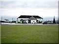
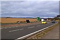
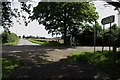
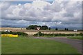
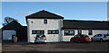
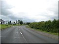
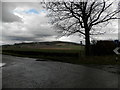
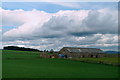
Photos of DD8 1XH


Area Information
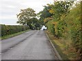
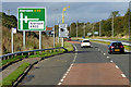
DD8 1XH is a small residential postcode cluster in Angus, Scotland, situated within a 1.0 km² area. This region lies within a council area renowned for its varied landscape, stretching from mountainous terrain in the north to fertile agricultural land and coastal stretches along the North Sea. The area is part of a larger region historically known as Forfarshire, with Forfar serving as the administrative heart. Living here means being close to both rural tranquillity and small-town amenities. The postcode is near Forfar, a town with a mix of historic architecture and modern services. Daily life here is shaped by proximity to agricultural areas, coastal scenery, and the cultural heritage of Angus, which includes sites like Arbroath Abbey and Glamis Castle. The area’s compact size makes it ideal for those seeking a quieter lifestyle without being isolated from essential services. With no major planning constraints like protected woodlands or wetlands nearby, it offers a straightforward environment for residents. The region’s economy is rooted in agriculture, fishing, and services linked to the North Sea oil industry, providing a stable backdrop for community life.
- Area Type
- Postcode
- Area Size
- 1.0 km²
- Population
- Not available
- Population Density
- Not available
House Prices in DD8 1XH
Showing 4 properties
| Address | Type | Beds | Baths | Last Sale Price | Last Sale Date | |
|---|---|---|---|---|---|---|
| Turwhappie Cottage, Access From Zu 363 Via Turnwhappie To A 90 T, Forfar, DD8 1XH | Detached | 5 | 2 | - | - | |
| Southbank, Access From Zc 55 To Southbank, Forfar, DD8 1XH | Detached | - | - | - | - | |
| Newlands Farm, Access From Zu 363 Via Newlands To A 90 T, Forfar, DD8 1XH | Unknown | - | - | - | - | |
| Turwhappie Farm, Access From Zu 363 Via Turnwhappie To A 90 T, Forfar, DD8 1XH | Bungalow | - | - | - | - |
Energy Efficiency in DD8 1XH
Residents of DD8 1XH have access to essential amenities in nearby Forfar, including retail options like Spar Forfar, Asda Forfar, and Aldi Forfar. These stores provide everyday shopping convenience, supporting a practical lifestyle. The area’s proximity to Forfar, a historic town, means residents can also explore cultural and historical sites, such as Arbroath Abbey and Glamis Castle, which are significant landmarks in Angus. The region’s natural beauty, including coastal landscapes and upland glens, offers opportunities for outdoor activities. While the data does not specify parks or leisure facilities within the postcode itself, the broader Angus area is known for its scenic walking trails and rural vistas. The small-town character of Forfar, combined with nearby agricultural and coastal environments, creates a balanced lifestyle. For those who enjoy a mix of historic charm and accessible amenities, DD8 1XH provides a base with connections to both local and regional services.
Amenities
Schools
| Rank | School | Type | Entry gender | Ages |
|---|
Explore more schools in this area
Go to Schools tabDemographics
Household Size
Accommodation Type
Tenure
Ethnic Group
Religion
Household Composition
Age
Household Deprivation
NS-SEC
Explore more demographic insights in this area
Go to Demographics tabPlanning
Planning Constraints
- Flood RiskPremium
- Ramsar Wetland SitesPremium
- Area of Outstanding Natural BeautyPremium
- Protected Nature ReservePremium
- Protected WoodlandPremium
- Crime RiskPremium