Area Overview for DD8 1QW
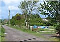
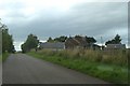
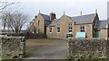
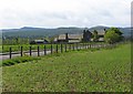
Photos of DD8 1QW
Area Information
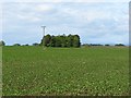
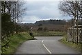
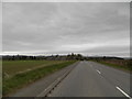
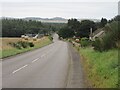
DD8 1QW is a postcode located in Angus, Scotland, covering a small residential cluster of 3.5 hectares. You live in a specific enclave within a county known as the birthplace of Scotland. The Declaration of Arbroath was signed at Arbroath Abbey in 1320, establishing the historical significance of the region you call home. Angus borders Aberdeenshire, Dundee City and Perth and Kinross, with the historic county town of Forfar serving as an administrative centre nearby. The area offers a varied landscape ranging from expansive mountains and valleys to prime agricultural land. Forfar, Arbroath, Brechin, Carnoustie, Kirriemuir and Montrose are the main towns within the council area. As a resident of this small area, you benefit from proximity to the North Sea oil industry presence and tourism hubs like Glamis Castle and Bell Rock Lighthouse. The local economy relies heavily on agriculture, fishing and the quarrying industry, alongside the global pharmaceuticals company GSK which has a significant presence in Montrose. Living in DD8 1QW means being part of a community defined by its rural roots and strategic location on the east coast of Scotland.
- Area Type
- Postcode
- Area Size
- 3.5 hectares
- Population
- Not available
- Population Density
- Not available
The housing stock in DD8 1QW caters to a market defined by the pragmatic needs of a small residential cluster. This specific postcode area does not provide explicit home ownership percentages or detailed accommodation type statistics in the available records. Instead, the broader market trends in Angus suggest a mix of older properties and newer builds catering to those seeking proximity to the North Sea coastline and historic sites like Glamis Castle. The region's economy, driven by agriculture, fishing and the presence of GSK in Montrose, creates demand for homes suitable for various lifestyles, from rural retreats to commuter properties near the main towns. You find that the market here is intensely local, with residents focusing on practical amenities such as the Spar and Co-op Kirriemuir within reach. The property market does not offer the crumbling infrastructure found in older industrial zones but rather benefits from the varied landscape of mountains and glens in the north. As you consider homes in DD8 1QW, you are looking at an area where the primary industries and tourism draw people forward. The market reflects the stability of a region that has been governed since the thirteenth century. You purchase a home that stands as part of a historic shire that evolved from Forfarshire. The focus is on solid, established properties that fit the character of a council area known for its rich history and natural beauty.
House Prices in DD8 1QW
Showing 2 properties
| Address | Type | Beds | Baths | Last Sale Price | Last Sale Date | |
|---|---|---|---|---|---|---|
| Burnside House, A 928 From Access To Leys Of Cossans To Access To Drumshademuir Caravan Park, Roundyhill, Forfar, DD8 1QW | Detached | - | - | - | - | |
| School House, U 378 From The A 928 At Roundyhill To C 22 E Of Burnside, Roundyhill, Forfar, DD8 1QW | Detached | - | - | - | - |
Energy Efficiency in DD8 1QW
Daily life in DD8 1QW revolves around a small network of essential amenities within practical reach. You have five notable retail and leisure options nearby, including Spar, Co-op Kirriemuir and Aldi Forfar. These venues provide the everyday necessities required for a self-sufficient lifestyle. The proximity to Kirriemuir means you have access to the J M Barrie Museum and the film maker's birthplace heritage. You can easily visit the historic notable features of the region such as Arbroath Abbey and Edzell Castle without needing to travel vast distances. The economy's reliance on agriculture and fishing supports a slower pace of life compared to the industrial hubs of the North Sea oil industry. You enjoy the quietness of a 3.5-hectare cluster while knowing that local services like the Co-op in Kirriemuir are just away. The area benefits from a history stretching back to 937 when Dubacan led his people. Nature lovers appreciate the lack of protected woodland or nature reserve designation, meaning the land remains accessible for your own use. You live in a setting where the highest point is Glas Maol at 3,502 feet, offering expansive views. The lifestyle combines the convenience of local shops with the grandeur of Scotland's ancient provinces and the scenic beauty of the east coast.
Amenities
Schools
| Rank | School | Type | Entry gender | Ages |
|---|
Explore more schools in this area
Go to Schools tabDemographics
The demographic profile for DD8 1QW draws upon the broader Anglian context where specific local census data for this exact cluster is not explicitly detailed in the provided records. However, the surrounding towns of Forfar and Kirriemuir, which serve the wider region, typically attract a mix of families and retired individuals drawn to the quiet countryside and historic sites. Notable features accessible to residents include Edzell Castle, Red Castle and Glen Esk, which attract visitors and locals seeking leisure activities. The economy remains anchored by agriculture and fishing, suggesting a workforce familiar with traditional industries and service provision for the North Sea oil sector. While specific household types or age profiles for this 3.5-hectare postcode are not broken out in the current data, the area benefits from the amenities found in nearby Kirriemuir and Forfar. The J M Barrie Museum in Kirriemuir is a prominent attraction within the county. Residents here likely value the cultural heritage found in the region, from the Pictish history of 100 BC to 900 AD to the modern council structure established in 1996. The diversity of the local population mirrors the council area's growth as a hub for goods and services. You move through an environment where the highest point is Glas Maol at 3,502 feet, offering dramatic views that define life in this part of Scotland.
Household Size
Accommodation Type
Tenure
Ethnic Group
Religion
Household Composition
Age
Household Deprivation
NS-SEC
Explore more demographic insights in this area
Go to Demographics tabPlanning
Planning Constraints
- Flood RiskPremium
- Ramsar Wetland SitesPremium
- Area of Outstanding Natural BeautyPremium
- Protected Nature ReservePremium
- Protected WoodlandPremium
- Crime RiskPremium