Area Overview for Brechin
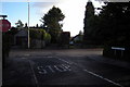
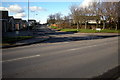
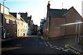
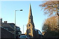
Photos of Brechin

Area Information
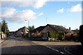
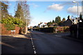
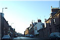
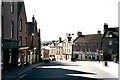
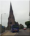
Brechin stands as a historic cathedral city within the built-up area of Angus, Scotland. This settlement occupies a modest footprint of 2.6 km², lying along the River South Esk at coordinates 56.733607, -2.659064. Christianity arrived in this location around 600AD with St Dubhoc, establishing a presence that would define the town's character for centuries. A Céli Dé religious order founded a church by the late 800s, later recorded in 972 when King Kenneth II endowed the site. The physical landscape reflects this deep heritage, featuring Brechin Cathedral with its distinctive 11th-century round tower and a main structure dating to the early 1200s. Brechin Castle, originally a defensive site from the 1200s, now serves as a converted mansion following reconstruction between 1696 and 1709. You walk past notable landmarks such as Maison Dieu Chapel, which began as a hospital in the 13th century. Life here involves a direct connection to Scotland's past, situated in a community shaped by events like the Battle of Brechin in 1452 where local clan forces aided King James II. Living in Brechin means residing in a compact, historically dense environment where every street corner holds narrative weight from medieval foundations to royalist victories. The area's small size ensures a focused community identity centered around these significant architectural and historical assets.
- Area Type
- Built Up Area 250
- Area Size
- 2.6 km²
- Population
- Not available
- Population Density
- Not available
Your daily life in Brechin benefits from a concentration of amenities within a small geographic reach. Within practical distance, you have access to five key retail outlets. Prominent venues include Farmfoods Brechin, Tesco Brechin, and Co-op Brechin, ensuring you can purchase groceries and essentials without travelling far. There are also two metro stations available, located in Brechin and Bridge of Dun, facilitating travel beyond the immediate neighbourhood. These transport nodes integrate with your shopping needs by providing access to wider regional networks. The area supports a functional lifestyle without requiring long commutes to distant high streets. You rely on these specific names of stores and stations for your routine. The historical character of the area adds to the setting, but your daily practicalities rest on the presence of these named retail and transport facilities. Living in Brechin means having Tesco and Farmfoods immediately accessible for weekly shopping. The two nearby stations offer further mobility. This combination of retail and transport creates a self-contained environment where basic needs and travel requirements are met locally.
Amenities
Schools
| Rank | School | Type | Entry gender | Ages |
|---|
Explore more schools in this area
Go to Schools tabDemographics
The demographic profile of Brechin reflects the realities of a specific built-up area in Angus. This section outlines the community composition based on available figures. The specific numbers regarding age profiles, household types, home ownership levels, and accommodation types are not included in the current information set. Without these precise statistics, it is impossible to state the exact racial diversity or income distribution of the residents. You cannot determine the percentage of single-person households versus families with children without concrete data. The deprivation data required to contextualize quality of life is similarly absent from the provided records. Consequently, any attempt to assign a specific level of social advantage or disadvantage to this area would be speculative. The only hard fact regarding the population landscape is the geographic scope of the built-up zone, which measures 2.6 km². This physical constraint influences the density of the community, though census figures detailing the internal demographic breakdown are not available for verification. Residents here exist within a defined historic boundary, but the statistical measures typically used to describe such populations remain unrecorded in the source material.
Household Size
Accommodation Type
Tenure
Ethnic Group
Religion
Household Composition
Age
Household Deprivation
NS-SEC
Explore more demographic insights in this area
Go to Demographics tabPlanning
Planning Constraints
- Crime RiskPremium