Area Overview for Kintore
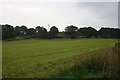
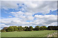
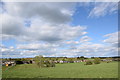
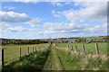
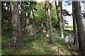
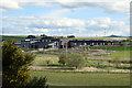
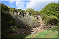
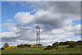
Photos of Kintore
Area Information
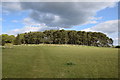
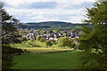
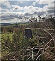
Kintore is a historic built-up area situated in Aberdeenshire, Scotland. The town rests on the banks of the River Don, now bypassed by the A96 road linking Aberdeen and Inverness. As of 2018, approximately 4,790 people inhabited the 1.9 square kilometre area. This community dates back over 5,000 years, making it one of the oldest towns in Aberdeenshire. You can see the town's evolution from a prehistoric settlement featuring Neolithic finds to the present day. The Kintore Town House, completed in 1747, remains the heart of the community. Former royal burgh status and a royal charter renewed by King James IV in 1506 define its heritage. Living in Kintore means residing among significant archaeological sites like the Deers Den Roman camp and the Pictish Kintore Churchyard Stone. These landmarks provide a tangible connection to the past within your daily environment. The area offers a blend of rural tranquility and access to modern conveniences found in nearby Inverurie and Aberdeen.
- Area Type
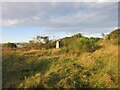
- Built Up Area 250
- Area Size
- 1.9 km²
- Population
- Not available
- Population Density
- Not available
Your daily life in Kintore offers access to five key retail venues within practical reach. You can shop at Sainsburys Kintore and Co-op Kintore for everyday groceries. CVS M&S Stevensons BP provides services for clothing and fuel needs. Three railway stations serve the broader region, with Kintore Railway Station historically significant though currently closed to passengers. Inverurie and Dyce stations remain options for rail commuters. For air travel, Aberdeen Airport and Aberdeen Dyce Airport provide flights to beyond the Borders. The nearby Hallforest Castle ruins offer a historical walk for enthusiasts. The Kintore Churchyard Stone stands as a War Memorial within the churchyard gateway. These amenities create a functional environment for residents. The A96 bypass ensures cars move quickly while avoiding the historic town centre. The combination of historical sites and modern transport links defines the local character. Living in Kintore blends access to essential services with proximity to major transport hubs.
Amenities
Schools
| Rank | School | Type | Entry gender | Ages |
|---|
Explore more schools in this area
Go to Schools tabDemographics
The community in Kintore centres around the documented population of 4,790 residents recorded in 2018. This figure reflects the demographic composition of the area at that time. The town functions as a distinct residential hub within Aberdeenshire. Specific data regarding age profiles, household types, and diversity is not present in the current records. Consequently, you cannot determine precise statistics on family sizes or marital status for this period. Accommodation types and home ownership levels also lack numerical breakdowns in the available information. Without these figures, it is impossible to state whether residents primarily own or rent their homes. Deprivation data required to assess quality of life against national standards is similarly absent from the dataset. You must rely on the known population size and the town's historical status to understand the community scale. The absence of detailed demographic splits means every claim about specific groups involves inference rather than hard numbers. The area remains a significant local node despite these data gaps.
Household Size
Accommodation Type
Tenure
Ethnic Group
Religion
Household Composition
Age
Household Deprivation
NS-SEC
Explore more demographic insights in this area
Go to Demographics tabPlanning
Planning Constraints
- Crime RiskPremium